Issue Date: Friday, September 16th, 2016
Issue Time: 9:00AM MDT
Summary
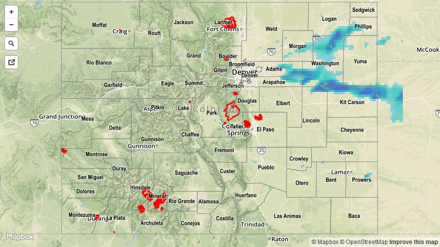
Rain coverage and intensity continued to decrease on Thursday, compared to Wednesday. This was caused by a sharp drop in moisture levels as measured by surface dew point temperatures and precipitable water values. Nonetheless, several clusters of scattered storms formed over the Northeast Plains where just enough instability remained. Despite the marginal moisture, a few storms were able to maintain very strong updrafts and their tracks spanned several counties. In particular, one cell that formed in southern Washington County tracked for hundreds of miles into Kansas, eventually causing flash flooding and strong winds in addition to big hail. So how big was the hail? A report of 2.75 inches was received in Kit Carson County with numerous other reports in the 0.75 to 1.75 inch range. Needless to say, yesterday’s storms certainly made the most of their marginal environment to produce worst-case scenario type hail.
Aside from the hail aspect, some short-term heavy rainfall was also seen on Thursday though high cloud bases were a mitigating factor. The highest 24-hour rain totals from CoCoRaHS was 0.61 inches in Washington County. Radar estimates suggest that up to 1.25 inches of rain fell in eastern Kit Carson County. However, radar estimates should be accepted with caution due to possible overestimation from hail core scattering.
Elsewhere, it was a pleasant, seasonably mild Thursday across the state. Aside from some isolated showers, gusty winds were also common during the mid-afternoon hours.
Flooding was not reported on Thursday. For rainfall estimates specific to your area, check out our Storm Total Precipitation map below.