Issue Date: Wednesday, September 7, 2016
Issue Time: 9:00 AM MDT
Summary:
Yesterday was an active day in the Southeast Plains and the Raton Ridge as moisture continued to be drawn into the region along with the moist southwesterly flow from Hurricane Newton. Scattered thunderstorms began to pop up and move into the region just prior to 2:00 PM MDT with heavy rainfall and strong winds reported in some locations; a wind gust of 76 mph was observed in Prowers County. Easterly upslope flow caused smaller isolated thunderstorms to form along the Urban Corridor and move into the Northeast Plains and Palmer Ridge in the late afternoon. Weather remained sunny and dry throughout the High Country and Western Slopes.
No flash flooding occurred yesterday.
Significant rainfall totals, according to CoCoRaHS observers (reports as of 7 AM MDT), are given below:
Prowers County: 0.90 inches
Baca County: 0.83 inches
Otero County: 0.59 inches
Kiowa Country: 0.29 inches
Cheyenne Country: 0.09 inches
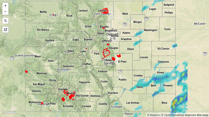
For a statewide look at 24-hour precipitation totals, please take a look at the Storm Total Precipitation map below.