Issue Date: Thursday, September 1, 2016
Issue Time: 9:10AM MDT
Summary
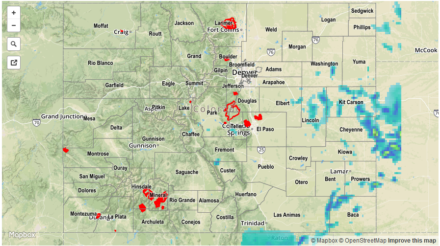
A notable downtick in rainfall coverage was observed on Wednesday as the long-lived upper-level disturbance that affected Colorado’s weather continued to dissipate. Nonetheless, plenty of residual moisture was found east of the Continental Divide with precipitable water values as high as 1.2 inches along the Kansas border. Highest storm coverage was found across the eastern Palmer Ridge and Southeast Plains. Activity started shortly after noon and slow moving storms dumped torrential rainfall over 30 – 90 minute periods. An areal flood advisory was issued across Kit Carson County in the mid-afternoon for field and road flooding. The highest observation in the area was 1.75 inches in Cheyenne County although radar estimates suggest over 2 inches in the area. This complex of storms slowly moved south during the afternoon though it appears rainfall rates were generally below 1.5 inches per hour. A second group of storms formed farther west over the Southeast Mountains, Central Mountains and San Juans. These storms produced less rainfall, perhaps up to 1 inch, but over the higher terrain this can be impactful. An areal flood advisory was issued over Chaffee County, while a flash flood warning was issued over the Hayden Pass fire scar where about 0.4 – 0.5 inches of rainfall fell.
Elsewhere, it was a seasonably warm and relatively calm day with plenty of sunshine. Certainly a nice break after a string of active weather days.
No official flooding reports were received yesterday. For rainfall estimates specific to your area, check out our Storm Total Precipitation map below.