Issue Date: Monday, August 22nd, 2016
Issue Time: 9:00AM MDT
Summary
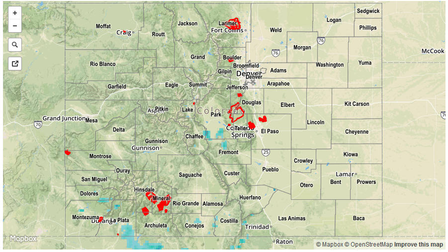
The weather pattern on Sunday resembled that of Saturday, with round of showers and thunderstorms being limited to the climatologically favored far southern tier of the state. Storms popped up early, but were initially of the garden variety type with very short-term heavy rainfall. By later in the afternoon, outflow boundaries were able to create more favorable convergence zones allowing for some larger and stronger thunderstorms to form. In all, rainfall coverage was quite similar to Saturday, with slightly lower amounts. Highest gaged totals were near 0.75 inches in Archuleta County. However, radar estimates suggest up to 1 inch fell over a few different locations in the Southeast Mountains and San Juans. Notably, even the San Luis Valley picked up appreciable rainfall amounts exceeding 0.5 inches. No official flooding reports were received as of this morning.
Elsewhere, afternoon temperatures on Sunday were up to 20F warmer than Saturday, though only putting them slightly above seasonal normal for this time of year.
For rainfall estimates specific to your area, check out our Storm Total Precipitation map below.