Issue Date: Saturday, August 20th, 2016
Issue Time: 9:00AM MDT
Summary
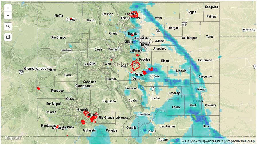
A fall-like cool, or even cold-front raced south-southeast out of Montana and Wyoming and crossed into Colorado by mid-afternoon on Friday. Prior to the cool front passage, mostly clear skies resulted in ample instability for many areas east of the Continental Divide. Thunderstorms erupted early along the higher terrain of the Front Range and eventually congealed into a complex that quickly moved southeastward. Plenty of short-term heavy rain rates were observed. For example, a Fort Collins ALERT gage picked up 0.79 inches in less than 30 minutes, several Urban Drainage and Flood Control District gages received between 0.6 and 0.8 inches in 30 minutes (including 0.5 inches in 10 minutes) and a USGS gage in El Paso county received over 1.5 inches per hour. While most of the rainfall was too short-term to cause any flooding issues, two flood-related alerts were posted: a Flood Advisory near Highlands Ranch and a Flash Flood Warning just northeast of Colorado Springs. The only official flooding report this morning was received from near Peyton where flooded roads were noted.
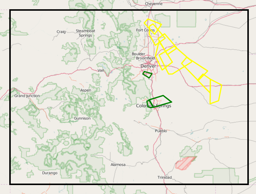
In addition to the heavy rainfall, plenty of hail and high wind reports were also tallied. By far the most impressive storm of the day originated just northeast of Fort Collins and then trekked for over 100 miles southeastward while causing many hail reports up to 1 inch (higher sizes probably fell but were not observed) and wind speeds up to 81 mph. You can see the trail of the storm in the map below from Iowa State University, showing the numerous severe thunderstorm warnings that it tallied (in yellow).
Meanwhile, on the western slope, the weather was much quieter on Friday. A few scattered showers and weak thunderstorms were seen but rainfall amounts were limited to about 0.25 inches except for a few higher amounts in the San Juans.
For rainfall estimates specific to your area, check out our Storm Total Precipitation map below.