Issue Date: Friday, August 19th, 2016
Issue Time: 9:00AM MDT
Summary
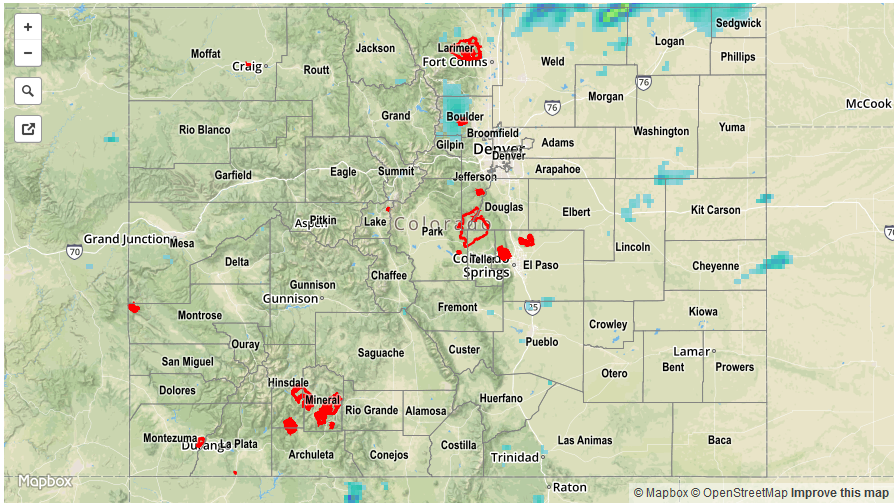
Widespread light to moderate rainfall fell across many parts of Colorado on Thursday, thanks to a large disturbance approaching the state from the southwest. Precipitable water values rose gradually into the 0.8 – 0.9 inch range, support localized areas of heavy rainfall. The main limiting factor was instability, as a good deal of the moisture was located above the boundary layer making it less effective in feeding thunderstorm updrafts. Nonetheless, rainfall amounts of 0.25 to 0.5 inches over an hour or two were common across many parts of the San Juans, Central Mountains, Southeast Mountains, Front Range and Urban Corridor. The highest 24-hour CoCoRaHS total came in at 1.02 inches from La Plata county, though higher amounts up to 2 inches likely occurred between rain gages. Most rainfall fell during the afternoon and early evening hours, but light to moderate showers were ongoing in the Southeast Plains overnight.
A few stronger storms were noted along the Cheyenne Ridge near the Wyoming border with up to 1.5 inches of rainfall falling in Weld County. Fortunately, no severe weather reports were received from this activity, though it’s possible that there was no one there to see it.
No official flood reports were received as of this morning, however two Areal Flood Advisories were issued on Thursday afternoon: one just north of Grand Junction near I-70, and another for parts of Rocky Mountain National Park.
For rainfall estimates specific to your area, check out our Storm Total Precipitation map below.