Issue Date: 8/13/2016
Issue Time: 9:33 AM
A LOW FLOOD THREAT IS FORECAST FOR PORTIONS OF THE NORTHEAST PLAINS, URBAN CORRIDOR, PALMER RIDGE, SOUTHEAST PLAINS, RATON RIDGE, FRONT RANGE, AND SOUTHEAST MOUNTAINS.
A weak disturbance in the northwest flow aloft will be responsible for the increase in storm coverage today, mainly for areas along and east of the Continental Divide. This scenario is picked up well by this morning’s ensemble of high-resolution models, which I have decided to show below. West of the Divide, moisture is scarce, and very little activity is expected. The exception to this will be over the higher terrain of the San Juan Mountains and Southwest Slope, where a couple isolated showers/weak thunderstorms will have access to slightly better low-level moisture.
Helping the weak disturbance in the development of showers/storms over eastern Colorado will be the preferred terrain of the Front Rage/Southeast Mountains, Cheyenne Ridge, Palmer Ridge, Raton Ridge, as well as a surface convergence boundary laid across the eastern plains. Most storms will be garden variety, producing periods of moderate rainfall, gusty winds, and lightning. A few stronger storms are expected, with periods of brief heavy rainfall and small hail mixed in with the gusty winds/lightning. Outflow boundaries will locally enhance available moisture, and any storms interacting with another storm’s outflow will be the likeliest to produce heavy rainfall. For more details on timing and rain rates, please see the zone-specific discussions below.
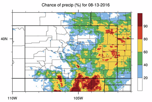
Today’s Flood Threat Map
For more information on today’s flood threat, see the map below (hover over threat areas for more details). For Zone-Specific forecasts, jump below the map.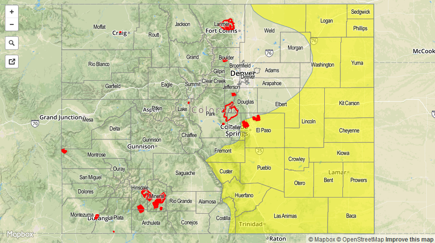

Zone-Specific Forecasts
Front Range, Southeast Mountains, Northeast Plains, Urban Corridor, Palmer Ridge, Southeast Plains, and Raton Ridge:
Isolated-to-scattered showers/storms are expected, most producing periods of moderate rainfall, gusty winds, and lightning. A few stronger storms are possible, producing periods of locally heavy rainfall and small hail. Maximum rain rates are as follows:
Front Range and Southeast Mountains: 0.6-1.0 inches/hour
Urban Corridor: 0.8-1.1 inches/hour
Palmer Ridge: 0.8-1.2 inches/hour
Northeast Plains: 1.2-2.0 inches/hour
Southeast Plains and Raton Ridge: 1.5-2.5 inches/hour
Timing: Noon – Midnight, with a couple showers/storms lingering into the early morning hours over the Southeast Plains/Raton Ridge
San Juan Mountains and Southwest Slope:
Isolated, high-based showers/weak storms expected over the higher terrain. Most rainfall will be light, with maximum rain rates of 0.4-0.6 inches/hour. Otherwise, mostly sunny skies will prevail.
Timing: 11 AM – 8 PM
Northern Mountains, Central Mountains, Northwest Slope, Grand Valley, and San Luis Valley:
Mainly dry under mostly sunny skies, with only a couple isolated showers/weak storms expected over the higher terrain near/along the Continental Divide. Most will only produce virga/gusty winds with light showers. Maximum rain rates will be 0.2-0.4 inches/hour.
A Fire Warning is in effect for Mesa County as a wildfire was reported in the vicinity of Horse Mountain. Please stay tuned to National Weather Service – Grand Junction for more information.
Timing: 11 AM – 8 PM