Issue Date: 8/10/2016
Issue Time: 9:37 AM
NO FLOOD THREAT IS FORECAST.
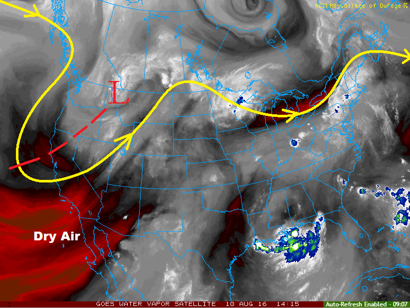
Current water vapor analysis shows that the upper-level low has not moved much from yesterday’s position, sliding northeast ever so slightly. This has kept Colorado under generally southwest flow aloft, and precipitable water has remained nearly steady from yesterday’s values. More specifically, this morning’s soundings from both Grand Junction (0.76”) and Denver (0.65”) show precipitable water values hovering near average for the date. Additionally, the soundings show an inverted-V profile, indicating that the main threat from most of today’s storms will be gusty winds and lightning, with light-to-moderate rainfall.
The eastern plains (east of I-25) and portions of southwest Colorado will be exceptions to the rule today, for two different reasons:
– The plains have better low-level moisture than areas to the west, thanks to being on the eastern side of a lee trough. Dewpoints range in the 50s to low 60s, which will be enough fuel for brief periods of heavy rainfall.
– For Southwest Colorado, a better moisture influx from the south will keep IPW values near the 1 inch mark, signalling fuel for efficient rainfall.
For both areas, storm motions and a lack of strong forcing will keep rain rates below flood threat levels, thus not flood threat is warranted. Areas of southwest Colorado that have received heavy rain over the past week or so will still need to be monitored for potential mud/debris/rock slide issues should a stronger thunderstorm, relatively speaking, move overhead.
Today’s Flood Threat Map
For more information on today’s flood threat, see the map below (hover over threat areas for more details). For Zone-Specific forecasts, jump below the map.

Zone-Specific Forecasts
Urban Corridor, Northeast Plains, Palmer Ridge, Southeast Plains and Raton Ridge:
Isolated-to-widely scattered showers/thunderstorms expected this afternoon and evening. Most will be run-of-the-mill, producing light-to-moderate rainfall, gusty winds, and lightning. One or two storms over the plains, east of I-25, will become stronger, producing brief periods of locally heavy rainfall and small hail. No flash flooding is expected, but street/field ponding is possible underneath any strong thunderstorms. Maximum rain rates will be as follows:
Urban Corridor and Palmer Ridge: 0.4-0.6 inches/hour
Raton Ridge: 0.4-0.8 inches/hour
Northeast Plains and Southeast Plains: 0.8-1.2 inches/hour
Timing: 1 PM – Midnight
Front Range, Northern Mountains, Southeast Mountains, Northwest Slope, San Juan Mountains, Southwest Slope, San Luis Valley, Central Mountains, and Grand Valley:
Widely scattered-to-scattered showers/storms expected. The best coverage, relatively speaking, will be over the Central Mountains, Southwest Slope, and San Juan Mountains. Most rain rates will be between 0.1-0.3 inches/hour, but a stronger storm or two will be possible, producing rain rates of 0.4-0.6 inches/hour. Otherwise, gusty winds and lightning will be the main threats.
Timing: 10 AM – 10 PM, with a few isolated showers lingering into the morning hours