Issue Date: Sunday, August 7th, 2016
Issue Time: 9:00 AM MDT
Summary
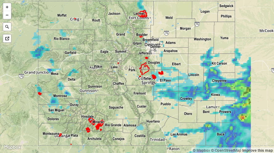
Unlike the middle and end of last week, the majority of heavy rainfall moved eastward over the Continental Divide on Saturday. Yesterday morning’s cloud cover pattern was a good proxy of who was going to see the most action. With generally clear skies in the southeast part of the state, this is where the heaviest rainfall fell. Several rounds of thunderstorms moved off the Palmer Ridge and intensified farther east towards the Kansas border. Although the highest 24-hour observations were limited to around 1.5 inches, there was undoubtedly higher amounts between gages. Radar-based estimates suggest up to 3 inches fell in the eastern parts of the Palmer Ridge, with up to 2 inches over the Southeast Plains. A strong, slow-moving storm also dumped up to 1.5 inches in 1 hour or less just west of Fort Collins. This prompted an areal flood advisory, but fortunately the storm quickly dissipated.
Even though coverage decreased west of the Divide, there were still storms to be had. Scattered short-term heavy rainfall amounts in the 0.5-0.75 inch range were common over the Grand Valley, Central Mountains and San Juans. A flash flood warning was hoisted in Montrose county with several debris slides and flooding reported in Naturita. A debris slide was also reported in Placerville. Though the rainfall amounts were not particularly heavy on Saturday, the area has seen copious amounts of rain over the past 4-5 days leading to water-logged soil. Many areas have seen at least a month’s worth of rainfall during that time-span, something that we will summarize more in the days ahead.
For rainfall estimates specific to your area, check out our Storm Total Precipitation map below.