Issue Date: Saturday, August 6th, 2016
Issue Time: 9:00 AM MDT
Summary
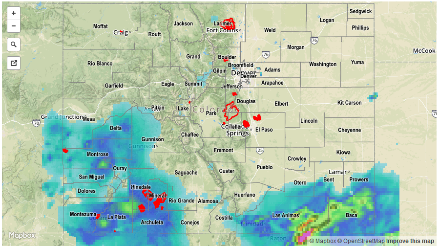
Very high moisture content continued to provide beneficial rainfall for southwest Colorado on Friday. Observed daily rain totals exceeding 1 inch were noted in La Plata, Montezuma, San Miguel, Archuleta, Dolores, Gunnison and Delta counties. The highest 24-hour totals in the region were over 2.5 inches in parts of La Plata County. It is possible that even heavier rainfall fell between rain gages. One flooding report was received from Durango where a debris slide caused a temporary closing of a road. About half a dozen flood warnings and advisories were issued throughout the day. In all, many parts of the San Juan mountains and Southwest Slope have received over 4 inches of rainfall over the past 96 hours. Lighter, but still meaningful, rainfall amounts have also been tallied over the Grand Valley and Central Mountains. Thank you monsoon.
The other area of heavy rainfall was over the Raton Ridge and Southeast Plains. Slow moving storms crossed into CO from NM in the mid-afternoon, initially delivering very heavy rainfall exceeding 1 inch for many (mostly rural) locations. The intensity lightened up by evening but light to moderate rainfall persisted through midnight. Several flood advisories were in effect, though no flooding reports were received. A report of 2.38 inches of 24-hour rainfall was noted in Las Animas County. However, radar estimates suggest that over 4 inches of rainfall likely occurred over isolated parts of the region.
Finally, it is interesting to note that heavy rainfall was expected farther north over the Palmer Ridge. Despite the seemingly high precipitable water (PW) values exceeding 1 inch, this never materialized because it took longer than expected to moisten the lower-levels of the atmosphere. In other words, although PW was high, it was “top-heavy” or located mostly in above the lowest ~5,000 feet, making it ineffective in fueling thunderstorms.
For rainfall estimates specific to your area, check out our Storm Total Precipitation map below.