Issue Date: Saturday, May 9th, 2015
Issue Time: 8:55 AM MDT
Summary:
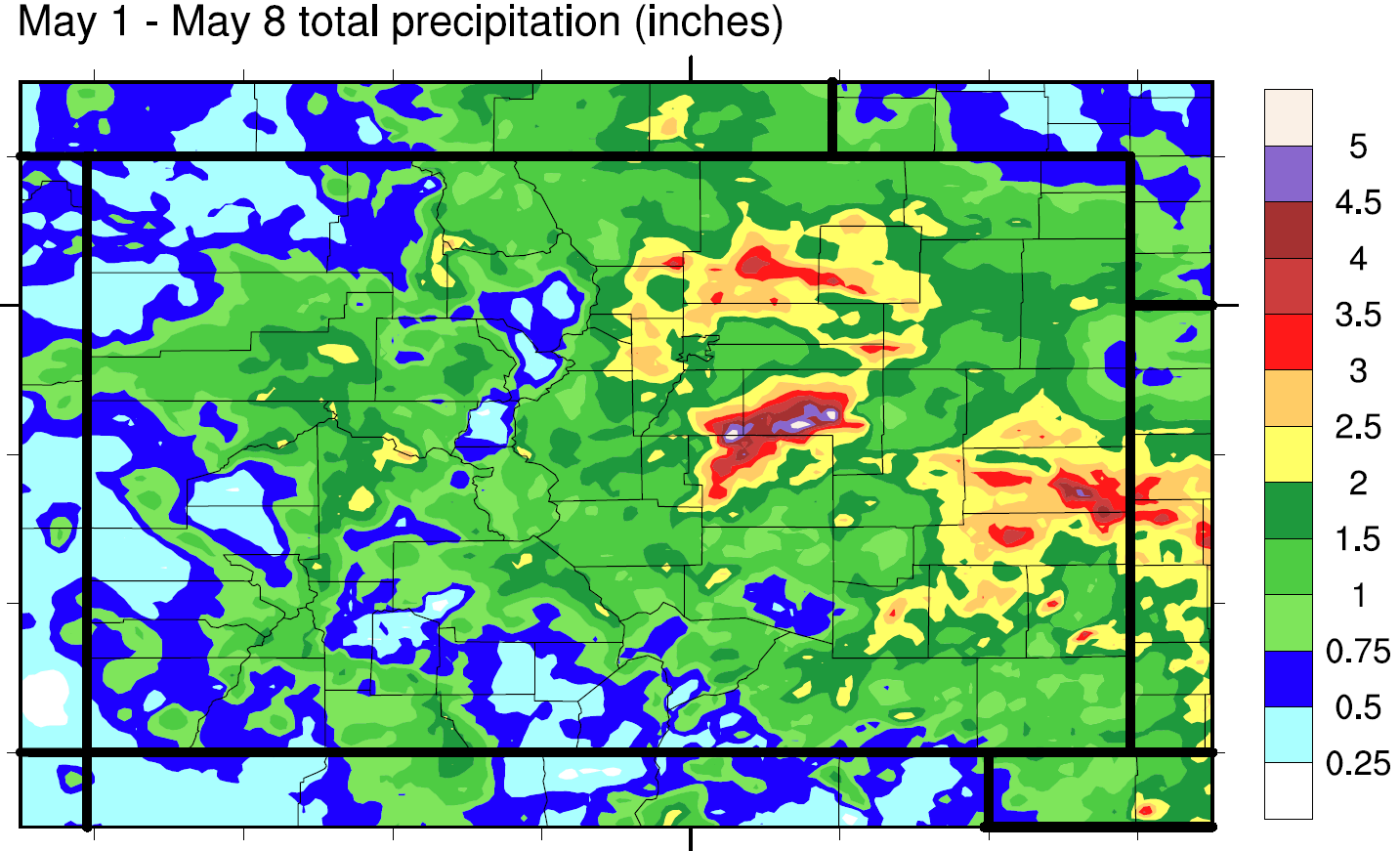
An impressive late spring cyclone marched towards Colorado on Friday bringing plenty of dynamics and moisture to cause widespread showers and thunderstorms across many regions of the state. In addition, numerous locations have experienced as much rainfall over the past week as typically falls in two to three months! The map below shows the estimated total rainfall observed from Friday, May 1 through Friday, May 8, the first full week of the Flood Threat Bulletin. And what a week it has been!.Note that this map goes through 6AM Friday, and thus does not include the additional hefty rainfall observed yesterday. We can see most of the state has seen more than one inch of rain with many locations east of the Continental Divide experiencing 2-3 inches, and up to 5 inches over the Palmer Ridge. Needless to say, soils are now saturated across almost all of eastern Colorado.
Now back to yesterday’s weather. As expected, morning shower and thunderstorm activity intensified in the late afternoon with multiple rounds of thunderstorms were observed in the late evening and overnight hours. Fortunately, the relatively cool weather limited the amount of moisture the atmosphere can hold, keeping hourly rainfall intensity below 1.5 inches per hour. Nonetheless, the persistence of the rainfall caused numerous flood warnings and advisories. In addition, four confirmed flooding reports were recorded:
• Fire department reported flash flooding in La Junta
• Law enforcement reported 6-8 inches of water covering I-25 near Colorado Springs
• Several debris slides were noted in Boulder county
• Two to four feet of water covered a gold course in Weld county
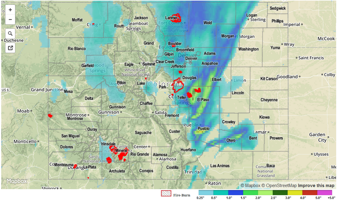
Observed 24-hour rain totals exceeded 3 inches in El Paso and Morgan counties, while 1 inch or more was noted across a long list of counties in Northeast Colorado. As always, please see the map below for estimated rain totals in your area.
Lastly, a few thunderstorms in the Southeast Plains had enough instability to cause large hail up to 1.75 inches in diameter. Meanwhile, smaller hail in the 0.25 to 0.75 inch range, was observed at a handful of different locations west of the Continental Divide. Note that hail (which appears as a very strong signal in radar reflectivities) may have caused slightly overestimated rainfall amounts in Pueblo, El Paso and Elbert counties.