Issue Date: Saturday, July 16th, 2016
Issue Time: 9:00AM
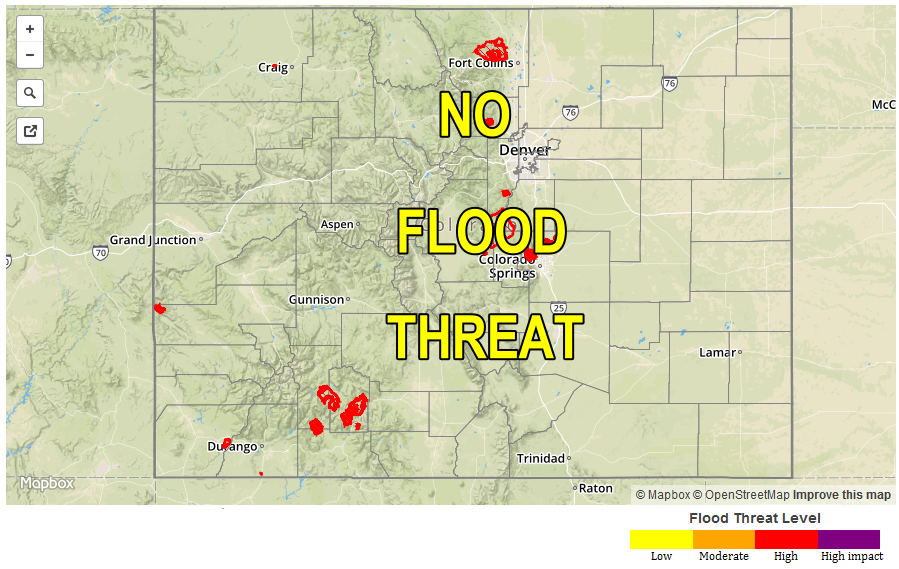
— Flooding is NOT expected today
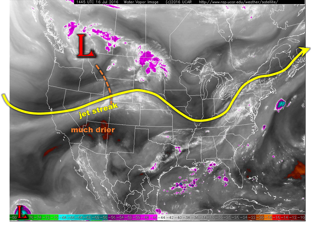
This morning’s water vapor image, below, shows a strong large-scale disturbance centered on the northwest US. It is accompanied by a moderate intensity jet streak that is positioned along the WY/CO border extended west-southwestward. This area of 60+ mph upper-level winds will usher in much drier air statewide. Some residual moisture is found this morning east of the Divide, especially near the surface. Slightly deeper moisture is found eastwards towards the KS border. It is likely that most of the deeper moisture will mix out before the atmosphere has time to generate strong thunderstorms. Thus, while isolated to widely scattered storms will be possible in the Front Range and Northeast Plains, heavy rainfall is not expected today. Thus, there is no flood threat.
 The far bigger story today will be a very high wildfire risk for the higher terrain and western slope. Relative humidity values are expected to drop below 20% across many areas, along with gusty winds as strong solar heating causes downward momentum transport from the overhead jet streak. Ongoing fires will be vulnerable, while new fires are possible especially from dry lightning.
Today’s Flood Threat Map
For more information on today’s flood threat, see the map below (hover over threat areas for more details). For Zone-Specific forecasts, scroll below the map.
 Zone-Specific Forecasts:
Southeast Mountains, Raton Ridge, Palmer Ridge, Southeast Plains, Northeast Plains, Urban Corridor, Front Range:
Mostly sunny and hot with some high clouds streaming through during the late morning and afternoon. An isolated to widely scattered storm is possible in the Front Range and in the Northeast Plains. Maximum 1-hour rain rates up to 0.8 inch will be possible in eastern areas, and up to 0.4 inches closer to the mountains. Gusty winds up to 60 mph could accompany some of the strongest storms. Flooding is not expected today. A very high wildfire threat is in effect today for the foothills and higher terrain. A Red Flag warning is in effect for parts of the region. Stay tuned to NWS forecasts for local details.
San Juan Mountains, San Luis Valley, Northern Mountains, Grand Valley, Northwest Slope, Southwest Slope, Central Mountains:
Mostly sunny and hot with some high clouds possible, especially in northern areas. The big story today will be the very high wildfire threat across the region as low humidity values will combine with gusty winds for the afternoon hours. An isolated storm cannot be ruled out in the Northern and Central Mountains before dry air overwhelms their formation. Max 1-hour rain rates up to 0.2 inches possible, but the bigger threat will be lightning strikes and gusty winds. A Red Flag Warning is in effect for many areas. Stay tuned to NWS forecasts for local details.