Issue Date: Friday, July 15th, 2016
Issue Time: 9:00 AM MDT
Summary:
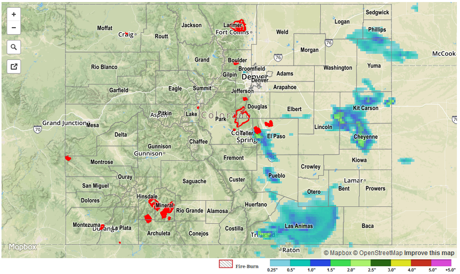
Mother Nature put on a show yesterday from the Front Range/Southeast Mountains and eastward. Strong-to-severe thunderstorms rumbled and produced large hail, strong winds, and periods of heavy rainfall. The Urban Corridor, Palmer Ridge, Southeast Plains, and Raton Ridge experienced the most coverage of storms, with lesser coverage for the Front Range, Southeast Mountains, and Northeast Plains. To the west, mostly sunny and dry conditions were the weather story.
Last night’s severe storms produced plenty of hail. Below are the reports meeting severe criteria (> 1.0 inches in diameter):
2.5 inch hail: Flagler (Kit Carson), 16 miles N of Bethune (Kit Carson)
2.0 inch: 2 miles S of Peterson AFB (El Paso), Peterson AFB (El Paso), 12 miles N of Kit Carson (Kit Carson),
1.75 inch: 3 miles NE of Model (Las Animas), 4 miles SSE of Pueblo Reservoir (Pueblo), 1 mile S of Pinion (Pueblo), 10 miles SSW of Blende (Pueblo), 8 miles SE of Elbert (Elbert), 2 miles S of Elbert (Elbert), 2 miles W of Flagler (Kit Carson), 3 miles S of Seibert (Kit Carson), Vona (Kit Carson), 6 miles N of Stratton (Kit Carson)
1.0 inch: Seibert (Kit Carson)
Street/field flooding likely occurred underneath strong/severe storms. For a closer look at rainfall totals in your area, please see the STP map below for a look at 24-hour precipitation totals.