Issue Date: Thursday, May 7th, 2015
Issue Time: 9:00 AM MDT
Summary:
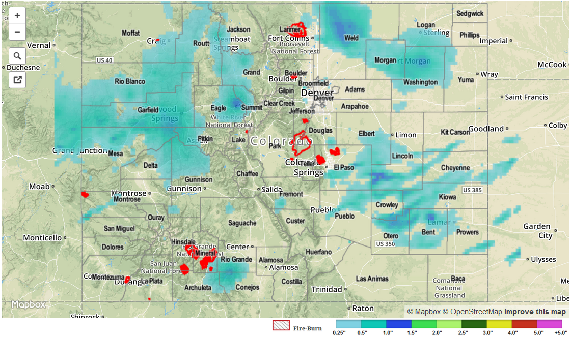
Moisture has remained steady for the last few days, and this led to another day of scattered showers and thunderstorms for Colorado. A few severe storms rumbled across the Southeast Plains, though because it is very sparsely populated, no severe reports were relayed to the local NWS office. 24-hour rainfall totals across the state were generally between 0.25 and 0.50 inches, however a few locations received around 1 inch. The highest totals reported by CoCoRaHS observers were the following:
Weld County: 1.49 inches
Larimer County: 0.96 inches
Prowers County: 0.91 inches
Morgan County: 0.89 inches
Storm reports to the local NWS offices across the state showed a mix of rain, hail, and even a funnel cloud. Storm reports of note, include:
Hail: 5 miles SW of Wiley (Bent County): 0.88 inch, 4 miles SW of Pueblo (Pueblo County): 0.75 inch
Funnel cloud: 2 miles NE of Fort Lyon (Bent County)
No flash flooding occurred yesterday.