Issue Date: Wednesday, June 22nd, 2016
Issue Time: 10:45AM MDT
— Flooding is NOT expected today
The famous ridge that has been in our discussion for the better part of two weeks has shifted slightly east this morning, and is now centered over west Texas (see water vapor image below). The northward flow to its west has allowed some mid-level moisture to enter Colorado from the morning. Farther east, a cool-front has resulted in substantial cooling and some drying of the lower atmosphere east of the Continental Divide. However, this front will have a hard time making it all the way into southeast Colorado and hot temperatures are expected here again (it’s already 93F in Springfield as of 10AM!).
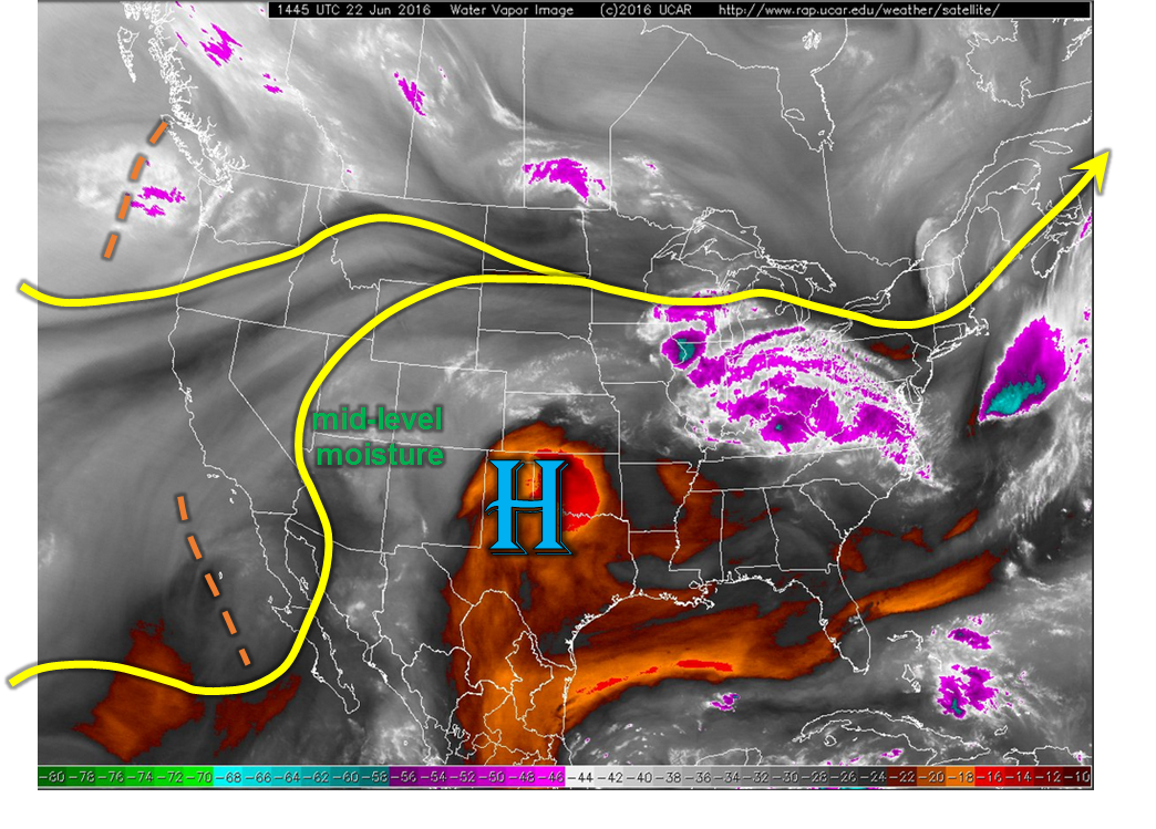
There are two features that will drive most of today’s weather. The heating of the higher terrain will result in scattered to widespread high-elevation thunderstorms, very similar to past days. In addition, the aforementioned cool front could (keyword: could) also provide a focusing mechanism for storm activity in southeast Colorado. Although some model guidance is painting a rather wet picture today, the downsloping flow and relatively minimal low-level moisture profile makes this rather hard to believe. Instead, we see a similar evolution of rainfall, but more coverage, compared to yesterday. Flooding is not expected today. Instead, gusty winds may be the bigger story.
Today’s Flood Threat Map
For more information on today’s flood threat, see the map below (hover over threat areas for more details). For Zone-Specific forecasts, scroll below the map.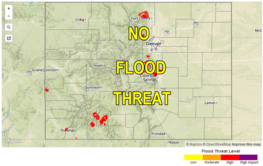
Zone-Specific Forecasts:
Urban Corridor, Northeast Plains, Palmer Ridge, Southeast Plains, Southeast Mountains, Raton Ridge, Front Range:
Partly cloudy and much cooler with high temperatures around seasonal normal, except for the far southeast where hot weather will persist. Scattered to widespread high-elevation thunderstorms are expected this afternoon into the early overnight hours (in the southeast). Max 10-minute rainfall up to 0.4 inches will be possible, with max 1-hour rainfall up to 0.8 inches. Flooding is not expected today. Primetime is as follows:
Raton Ridge and Southeast Plains: 1pm to midnight
All other regions: 1pm to 8pm
There is a possibility of persistent gusty winds along the Palmer Ridge, Front Range and Raton Ridge as thunderstorm mix higher momentum air to the surface. Sustained winds of 30-40 mph, with gusts up to 60 mph, can be expected immediately behind the passage of thunderstorms.
San Juan Mountains, San Luis Valley, Northern Mountains, Grand Valley, Northwest Slope, Southwest Slope, Central Mountains:
Sunny early and slightly cooler today. Scattered weak thunderstorms will be possible in the higher terrain especially in the central and southern parts of the area. Max one hour rainfall up to 0.5 inches is possible. Flooding is not expected today. Gusty winds up to 50mph could accompany some of the stronger storms.