Issue Date: Tuesday, June 21st, 2016
Issue Time: 9:00AM MDT
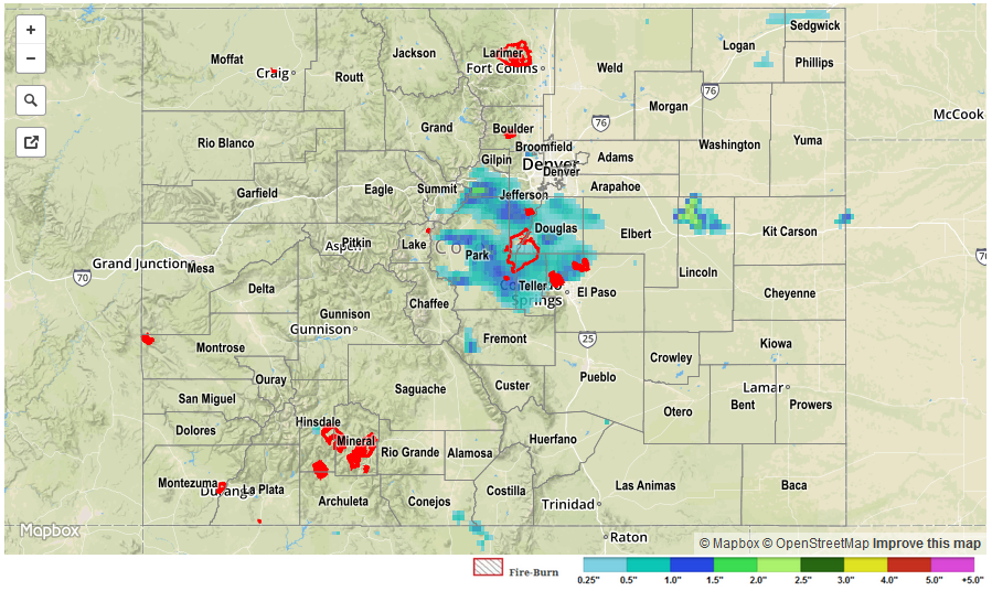
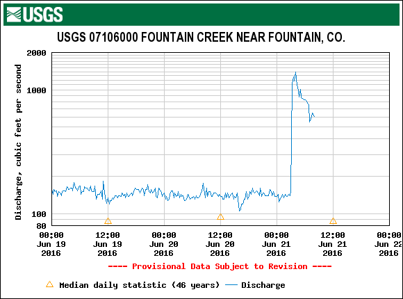
A pool of cool moist air pushed into Colorado from the northeast on Monday morning, helping to stabilize the atmosphere and limit highs to the 70s in parts of the Northeast Plains and Urban Corridor. However, that same air helped to spark off some impressive late afternoon thunderstorms as it lifted over the Palmer Ridge and Front Range foothills and mixed with much warmer air. Very heavy short-term rainfalls were observed in Douglas, Park, Teller, Fremont and El Paso counties. Several Urban Drainage and Flood Control District gages picked up about 0.5 inches in 10 minutes. A USGS gage north of Colorado Springs picked up about 1.5 inches per hour. Highest 24-hour totals were in the 1.5 to 2.0 inch range for that region. The flow at Fountain Creek spiked in the late evening and overnight hours, as shown in the hydrograph below. Three Areal Flood Advisories were issued, as was a Flash Flood Warning for the Waldo Canyon burn scar.
In addition to the heavy rainfall, a few stronger storms produced hail up to 1.75 inches in diameter. A rare tornado warning was also issued for Park County.
Elsewhere, very hot temperatures were the story over the southeast and western parts of the state. Grand Junction, Pueblo, Lamar and La Junta all surpassed the 100F mark, which is the second day in a row for this feat for the latter three sites.
No official flooding reports were received yesterday. For specific rainfall estimates in your area, check out our Storm Total Precipitation map below.