Issue Date: Monday, June 20th, 2016
Issue Time: 9:15AM MDT
The Rocky Mountain ridge was at its strongest point during its past ~2 weeks of existence leading to very hot afternoon temperatures statewide. Here are some of the specifics: 99F in Boulder, 103F in Pueblo and La Junta, 97F at DIA, 98F at Grand Junction and 96F at Cortez. Yesterday was the warmest day in a string of very warm weather covering the state during the past two weeks or so. Since June 1st, temperatures across Colorado have been 3-10F above average.
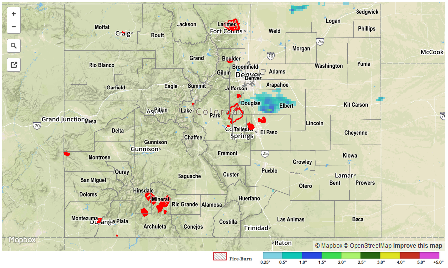
While most of the day stayed dry, a weak frontal boundary kicked off a handful of weak to moderate thunderstorms on the north face of the Palmer Ridge. One particular cell stood out as it moved from Douglas into Elbert County. Hail up to 1.25 inches and heavy rainfall, up to about 0.75 inches per hour was noted with this storm prompting several severe thunderstorm warnings and even an areal flood advisory from the Boulder National Weather Service. In all, four reports of 1+ inch rainfall was observed in the area. However, flooding was not reported.
For specific rainfall estimates in your area, check out our Storm Total Precipitation map below.