Issue Date: Sunday, June 19th, 2016
Issue Time: 9:00AM MDT
— Flooding is NOT expected today
— Elevated wildfire threat for central and western parts of the state
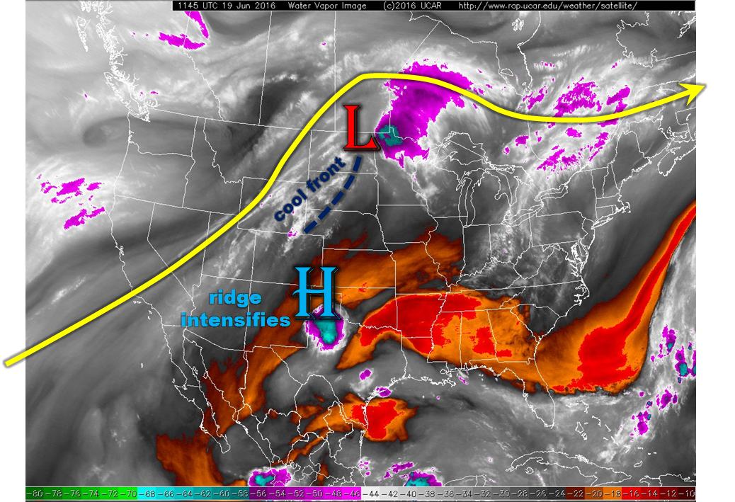
The water vapor image, below, continues to show the infamous ridge centered just south of Colorado this morning. Today could mark the high-point of the ridge’s strength with afternoon 500-mb heights (roughly 8,000 – 14,000 feet above ground level, depending on elevation) forecasted to exceed an impressive 6,000 meters. The net effect of this will be strong mid-level subsidence that will continue to squash precipitation chances statewide. The only other notable feature on the weather map is a weak cool front that is currently moving south and east out of Wyoming. This will provide the only potential for rainfall across the Palmer Ridge to the Northeast Plains. However, rainfall chances and coverage here will be very low. Flooding is not expected today.
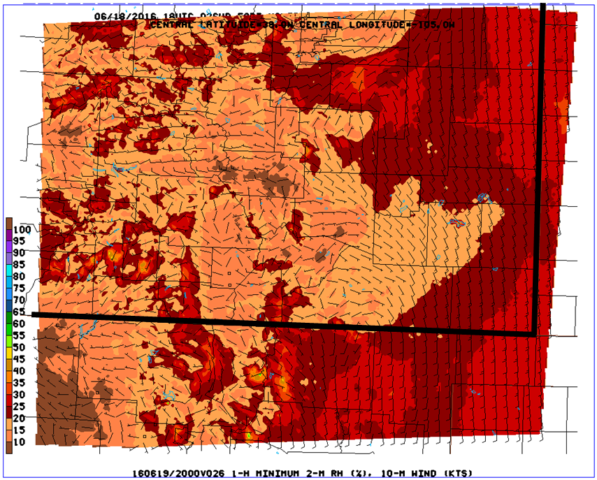
Prolonged warm and dry weather in Colorado is often accompanied by an elevated wildfire threat. This afternoon, widespread parts of the state will once again experience relative humidity values less than 20%, and less than 10% in many areas (see map below from the Fire-weather WRF). This will once again support wildfire chances. Fortunately, low wind speed will partially mitigate this threat.
Today’s Flood Threat Map
For more information on today’s flood threat, see the map below (hover over threat areas for more details). For Zone-Specific forecasts, scroll below the map.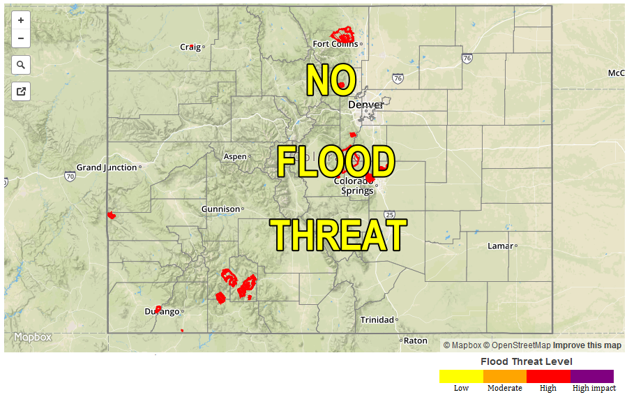
Zone-Specific Forecasts:
Urban Corridor, Northeast Plains, Palmer Ridge, Southeast Plains, Southeast Mountains, Raton Ridge, Front Range:
Sunny and hot today with high temperatures of 100 – 105F possible in the lower values. An isolated shower or very weak thunderstorm cannot be ruled out across the Palmer Ridge and Northeast Plains as a frontal boundary moves south. Maximum 1-hour rain rates will be below 0.4 inches. Flooding is not expected. The threat for wildfires remains elevated today.
San Juan Mountains, San Luis Valley, Central Mountains, Northern Mountains, Grand Valley, Northwest Slope, Southwest Slope:
Sunny and continued hot today with above average temperatures as high as 100F possible in the lower elevations of the Grand Valley. An elevated wildfire threat continues today with afternoon relative humidity values below 10% in some locations. Rainfall is not expected today, and neither is flooding.