Issue Date: Saturday, June 18th, 2016
Issue Time: 8:25AM MDT
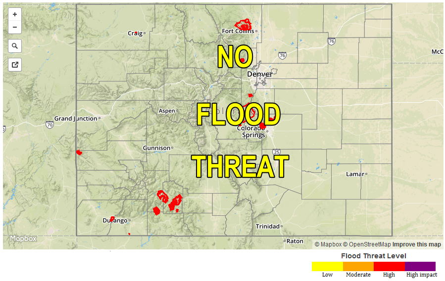
— Flooding is NOT expected today
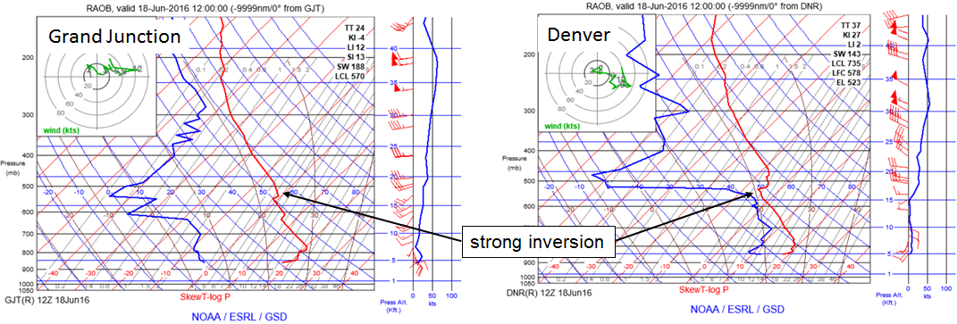
Low-level moisture is in place this morning east of the Continental Divide after yesterday’s cool front passage. Dew point temperatures are in the 45-55F range which is rather high by Colorado standards. However, this morning’s soundings at both Denver and Grand Junction, below, show a strong mid-level inversion being driven by the ridge centered over New Mexico. Mid-level temperatures have warmed up to 8F, and are now about 5F warmer than average. This prevents instability from building up, and strongly limits storm chances. Expect a gradual mixing out of moisture through some puffy clouds, along with hot temperatures statewide. The only slight chance of a shower or weak thunderstorm is in the extreme southeast portion of the state, but flooding is not expected today.
West of the Divide, soils have continued to dry with the lack of meaningful precipitation over the past several weeks. The wildfire threat remains elevated today, but the limiting factor is relatively low wind speeds. Nonetheless, folks should stay tuned to local National Weather Service updates regarding this threat.
Today’s Flood Threat Map
For more information on today’s flood threat, see the map below (hover over threat areas for more details). For Zone-Specific forecasts, scroll below the map.
 Zone-Specific Forecasts:
San Juan Mountains, San Luis Valley, Central Mountains, Northern Mountains, Grand Valley, Northwest Slope, Southwest Slope:
Sunny and continued hot today with above average temperatures as high as 100F possible in the lower elevations of the Grand Valley. An elevated wildfire threat continues today, mainly for the Central Mountains and San Juans; however, low wind speeds will keep this threat on the low side. Rainfall is not expected today, and neither is flooding.
Urban Corridor, Northeast Plains, Palmer Ridge, Southeast Plains, Southeast Mountains, Raton Ridge, Front Range:
Sunny early with some puffy afternoon clouds as low-level moisture is forced out of the boundary layer. An isolated shower or very weak thunderstorm cannot be ruled out in the far southeast part of the state today. Otherwise, it will be very warm with temperatures up to 100F possible in the lower elevations of the South Platte and Arkansas rivers.