Issue Date: 6/10/2016
Issue Time: 10:05 AM
A LOW FLOOD THREAT HAS BEEN ISSUED FOR THE GREEN RIVER IN WEST CENTRAL MOFFAT COUNTY, THE CACHE LA POUDRE RIVER AT THE CANYON MOUTH AFFECTING LARIMER COUNTY, AND THE CACHE LA POUDRE RIVER NEAR GREELEY AFFECTING WELD COUNTY.
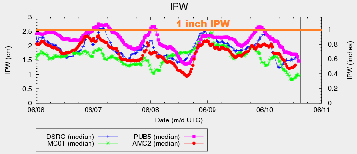
Upper-level ridging will be overtop Colorado today/tonight, leading to a day filled with mostly sunny skies and warm temperatures. There is a bit of moisture still in place beneath the ridge, evidenced in the IPW chart below. Closer inspection of the vertical profile of the moisture reveals that much of it resides in the mid-levels and, aside from some residual moisture near the surface, the lower-levels are fairly dry. This means that any isolated thunderstorms that are able to fire up will remain high-based, producing more wind and lightning than rain.
Many of the isolated thunderstorms will remain anchored to the higher terrain of the Continental Divide, Front Range, and San Juan Mountains. A few will drift over the adjacent valleys and lower elevations including the Urban Corridor and western portions of the Southeast Plains, Northeast Plains, and Raton Ridge. One or two isolated thunderstorms will also be possible across the Palmer Ridge as slight surface convergence develops this afternoon. Otherwise, the bulk of the state will remain mostly sunny and hot. For more details, please see the zone-specific forecast discussions below.
Today’s Flood Threat Map
For more information on today’s flood threat, see the map below (hover over threat areas for more details). For Zone-Specific forecasts, jump below the map.

Zone-Specific Forecasts
Urban Corridor, Northeast Plains, Palmer Ridge, Raton Ridge, and Southeast Plains:
Mostly sunny and hot will be the main weather story today, only broken up by a few isolated thunderstorms. Storms will be high-based, posing more of a gusty wind and lightning threat than rain. Wind gusts will be up to 40-50 mph. Maximum rain rates will remain fairly low, clocking in at 0.3-0.6 inches/hour. High temperatures will be in the low-to-mid 90s for most, with a few locations across the far eastern plains and in the Arkansas River Valley flirting with 100 F.
Timing: 2 PM – 10 PM
Front Range, Northern Mountains, Central Mountains, San Juan Mountains, Southeast Mountains, and San Luis Valley:
Mostly sunny and warm, with isolated thunderstorms over the higher terrain. A few storms will drift over adjacent valleys, and all will be fairly slow moving. Dry air beneath the cloud layer will reduce the threat of heavy rain, instead focusing today’s main threats on gusty winds (up to 40-50 mph) and lightning. Maximum rain rates will be 0.2-0.5 inches/hour.
Timing: Noon – 10 PM
Northwest Slope, Grand Valley, Southwest Slope:
Mostly sunny and hot. High temperatures will be running well above normal again today. A few high-based, fair weather clouds will be noted over the higher terrain of eastern portions of these regions.