Issue Date: Saturday, June 4th, 2016
Issue Time: 9:00AM MDT
— There is No flood threat today.
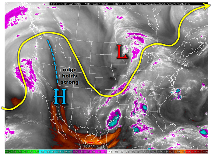
The water vapor image, below, continues to show the western U.S. ridge firmly in place. Colorado is displaced far enough east to be largely under its influence of very hot temperatures. The western part of the state will continue to be very warm, while the eastern part is just warm. Today’s Precipitable Water (PW) have risen a touch compared to yesterday morning, partly from wet soils and partly from weak moisture advection from the east. However, with the ridge in place and strong subsidence, rainfall will be hard to find. Isolated scattered showers or weak thunderstorms will likely pop up in the Southeast Mountains and San Juans during peak heating. But rainfall amounts will be well below critical levels.
Snowmelt continues in earnest today with up to 2.5 inches of snow water equivalent loss expected over the “luckiest” of locations. As such, high elevation streams continue to rise with some getting close to action levels; however, flooding is not expected today. A reassessment will be required for tomorrow (Sunday) and especially next week.
Today’s Flood Threat Map
For more information on today’s flood threat, see the map below (hover over threat areas for more details). For Zone-Specific forecasts, scroll below the map.

Zone-Specific Forecasts:
Front Range, Urban Corridor, Northeast Plains, Palmer Ridge, Southeast Plains, Southeast Mountains, Raton Ridge, San Juan Mountains, San Luis Valley, Central Mountains:
Mostly sunny and warm today with isolated to scattered showers and weak thunderstorms in the Central Mountains, Southeast Mountains and San Juans. Rainfall will be limited to 0.3 inches and flooding is not expected.
Northern Mountains, Grand Valley, Northwest Slope, Southwest Slope:
Mostly sunny and continued very warm today with highs in the low 90s in the lower elevation valleys. Rainfall is not expected, neither is flooding.