Issue Date: Thursday, June 2nd, 2016
Issue Time: 9:40AM MDT
— There is no flood threat today.
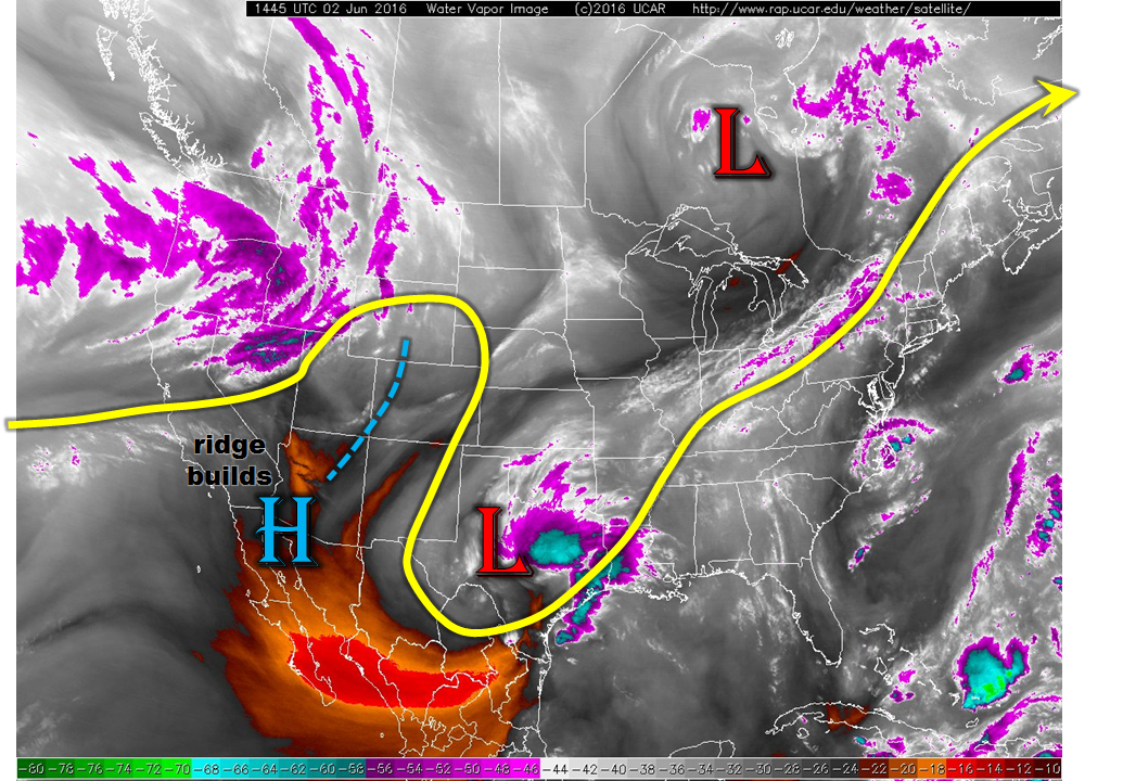
As seen in the water vapor image, below, the cut-off low skirting along the US-Mexico border is finally southeast of Colorado. Following in its wake is the first strong ridge seen during the young summer season. The ridge will continue to build north-northeast promoting strong height rises over the state, implying strong subsidence above the boundary layer. A few isolated thunderstorms are still possible given marginal moisture east of the Continental Divide. However, flooding is not expected. Much warmer temperatures, closer to seasonal normals, will be seen across the state.
Today’s Flood Threat Map
For more information on today’s flood threat, see the map below (hover over threat areas for more details). For Zone-Specific forecasts, scroll below the map.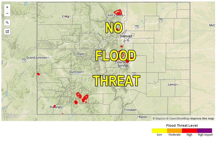
Zone-Specific Forecasts:
Front Range, Urban Corridor, Northeast Plains, Palmer Ridge, Southeast Plains, Southeast Mountains, Raton Ridge, San Juan Mountains, San Luis Valley:
Sunny early then turning partly cloudy with much warmer temperatures expected. An isolated thunderstorm is possible along the Kansas border as well as the New Mexico border from the San Juans through the Southeast Mountains. Maximum hourly rainfall up to 0.7 inches is possible in eastern areas, with up to 0.4 inches possible in southern areas. Flooding is not expected today.
Primetime: 2pm to 8pm
Central Mountains, Northern Mountains, Grand Valley, Northwest Slope, Southwest Slope:
Sunny early then partly cloudy skies with much warmer temperatures. Flooding is not expected today.