Issue Date: Wednesday, June 1st, 2016
Issue Time: 9:14AM MDT
In the summertime, the usual daily weather cycle across Colorado is for rain to fall in the mid to late afternoon hours, followed by dissipation towards sunset. Of course, there are many exceptions to this generality, as was seen on Wednesday. Scattered storms developed off the higher peaks of the Front Range and Southeast Mountains by early afternoon and progressed east-southeast. Rainfall with these early storms was light to moderate with rainfall rates of about 0.75 inches per hour being a common value.
However, as time passed, a fetch of moisture advecting up the Arkansas River valley provided more fuel for thunderstorms. Thus, activity quickly ramped up in coverage and intensity after about 6pm. By about 10pm, a widespread swath of very heavy rainfall, up to 2 inches per hour, was found between Pueblo and Lamar. By 11pm, residual instability and a small scale mid-level disturbance even ignited some weaker storms along the foothills of the Urban Corridor and into the Front Range. Fortunately, instability was very limited here and max hourly rainfall rates stayed below about 0.6 inches.
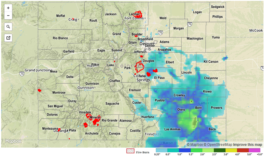
When all was said and done this morning, about half the area of the Southeast Plains received over 1 inch of rain, with a few locations receiving over 2 inches. A few of the more impressive amounts are:
- Las Animas (Bent County): 2.40 inches
- Fowler (Otero County): 2.29
- Crowley (Crowley County): 2.22
- Pueblo (Pueblo County): 1.67
- Boulder (Boulder County): 1.38
- Strasburg (Arapahoe County): 1.23
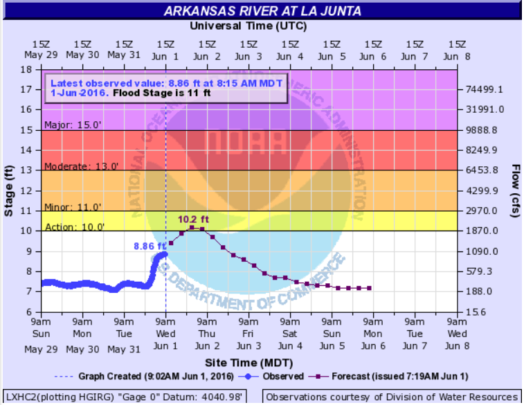
As expected, the runoff entering the Arkansas River is causing an impressive wave front, as you can see in the observed and forecast hydrograph near La Junta. However, even at the it’s crest, the river is expected to remain below Minor flood stage.
No official flood reports were received as of this morning, although it is likely that isolated field and roadway flooding occurred in rural areas of the Southeast Plains. For specific rainfall estimates in your area, please check our STP map below.