Issue Date: Monday, May 30th, 2016
Issue Time: 12:45PM MDT

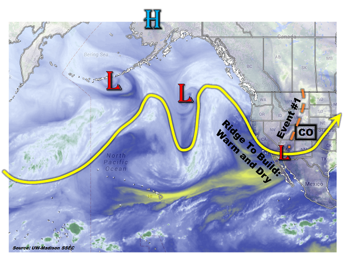
May has been a cool month for most of Colorado (see our Storm Total Precipitation discussion for 5/30/2016). As the water vapor image shows, below, an amplified pattern with at least two distinct ridge-trough couplets is seen across the vast North Pacific Ocean. At face value, this may seem to suggest that unsettled weather will continue as these features move east in the jet stream’s steering winds. But given that we are about to enter the first week of June, this is never guaranteed! Indeed, it appears that after tomorrow’s passage of a large-scale trough (Event #1) that will deliver widespread showers and thunderstorms, the overall pattern will calm down significantly.
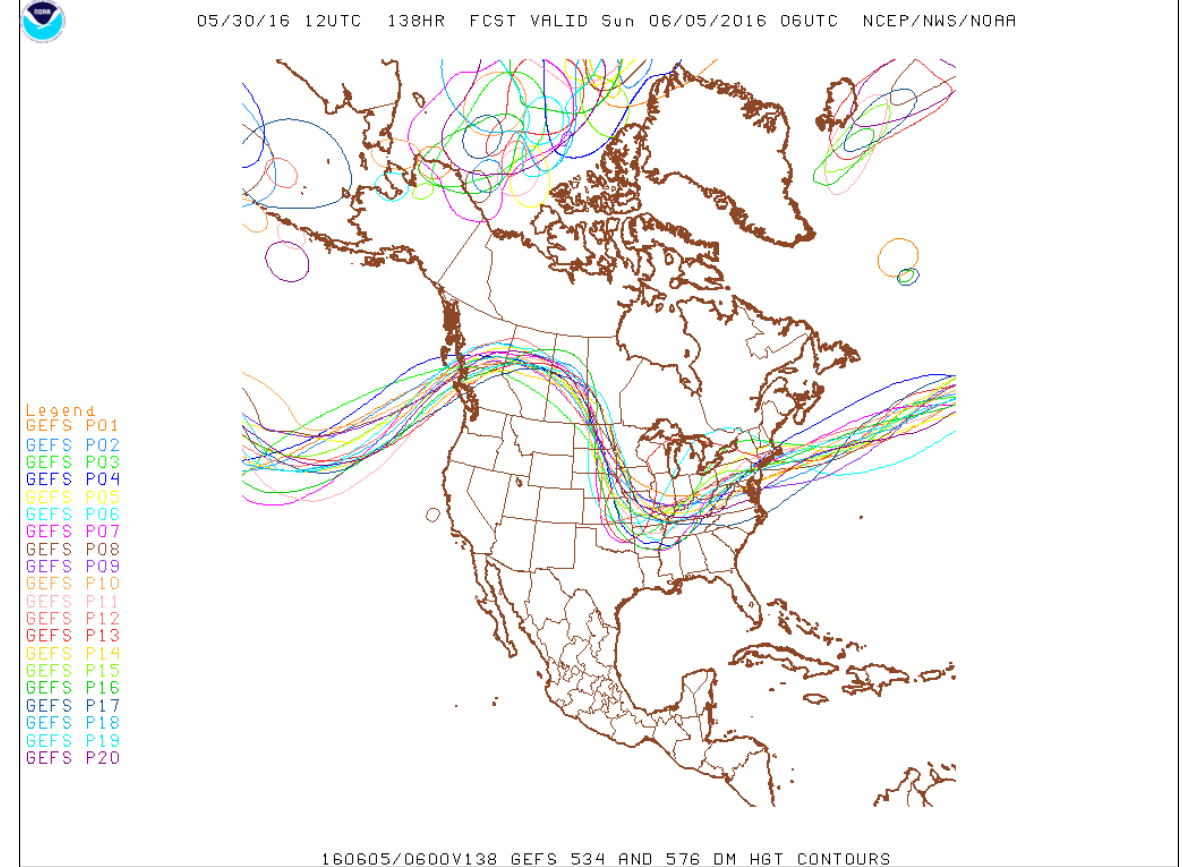
The reason for a calmer pattern will be the development of a stout early summer ridge that is currently in its infancy off the southwest US coast. The map below shows the GFS ensembles’ depiction of the upper atmosphere’s pattern for next Sunday 6/5. Note that by this time, there is essentially unanimous support for a ridge that covers the entire western United States. The implications of this are a prolonged warm and mainly dry period for Colorado starting mid-week last through at least mid-week next week. This does not imply that rainfall will not be found, but simply that it will be generally light and likely favoring high-elevation locations in accordance with Colorado’s summer climatology.
Thereafter, guidance is no longer as consistent, with some suggestions of the ridge quickly breaking down and storminess returning east of the Divide. There is enough loose consensus for us to bring in Event #2 starting late next week. However, there is not enough consensus to be able to estimate rainfall amounts, yet.
Event #1: Tuesday, May 31st
Elevated Flood Threat for Southeast Colorado
A cut-off low will propagate eastward, providing favorable dynamics for a widespread rain event for the Palmer Ridge, Southeast Mountains, Raton Ridge, Southeast Plains and parts of the Urban Corridor. A cool front passage will limit instability the farther north one goes, thus lighter rainfall rates will result north of Colorado Springs. In areas to the south, rainfall amounts up to 2 inches will be possible as at least one round of thunderstorms moves through the area during the afternoon and evening hours. An elevated flood threat is warranted for this region. Check out tomorrow’s Flood Threat Bulletin for the most up-to-date discussion and rainfall estimates.

Event #2: Saturday, June 11th through Monday, June 13th
No Apparent Flood Threat as timing of ridge weakening is uncertain
After a prolonged warm and mainly dry period, there are indications that the upper-level ridge will break down. This will open up the door for northwest flow and disturbances that could generate heavy rainfall mainly east of the Continental Divide. At this time, there is not enough guidance to pinpoint rainfall amounts. However, climatologically speaking, the northeast part of the state, including the Front Range and Urban Corridor, is the most likely target for the threat.