Issue Date: May 5th, 2015
Issue Time: 10:55 AM MDT
— Low flood threat for Southeast Plains
— Low flood threat for Front Range and Urban Corridor
— Low flood threat for Northwest Slope, parts of Northern Mountains and parts of Grand Valley
An impressive subtropical jet stream over the eastern Tropical Pacific Ocean and western Mexico continues to send upper-level disturbances north and eastward across Colorado. As the water vapor image shows below, another feature is just entering the state as of this morning. North of this feature, marked by the dashed black line, a plume of moisture, cold upper-level temperatures and dynamical wind forcing will continue to support showers and thunderstorms across our state.
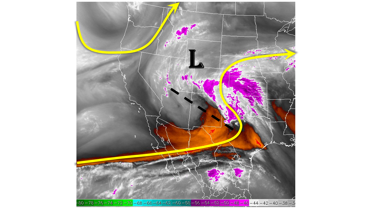
One difference from yesterday’s weather setup is that cloud cover will be more widespread and many areas may not see any sunshine at all. This is in contrast with yesterday, where areas along and south of the Palmer Ridge broke out of clouds, allowing temperatures to quickly jump into the mid-60s. The implication of today’s reduced sunshine will be less instability. Thus, even though precipitable water values remain quite high for this time of year, ranging from 0.7 in Boulder and Grand Junction to 0.8 in Pueblo, the lack of instability will be the main factor that will keep rain rates down. The one exception to this will be in the far eastern portion of the Southeast Plains, where sunshine may bolster temperatures late in the afternoon allowing for rainfall rates to approach 2.0 inches per hour.
However, the combination of yesterday’s widespread moderate to heavy rain amounts, elevated stream levels east of the Continental Divide and today’s steady rain rates of 0.4 to 0.7 inches will require a Low flood threat. Additionally, part of the Northern Mountains and Northwest Slope have been added to a Low flood threat because these areas are likely to experience the most sunshine today, raising temperatures and instability.
Please see below for area-specific forecasts (click on “About the FTB” link above to view Colorado area-specific regions).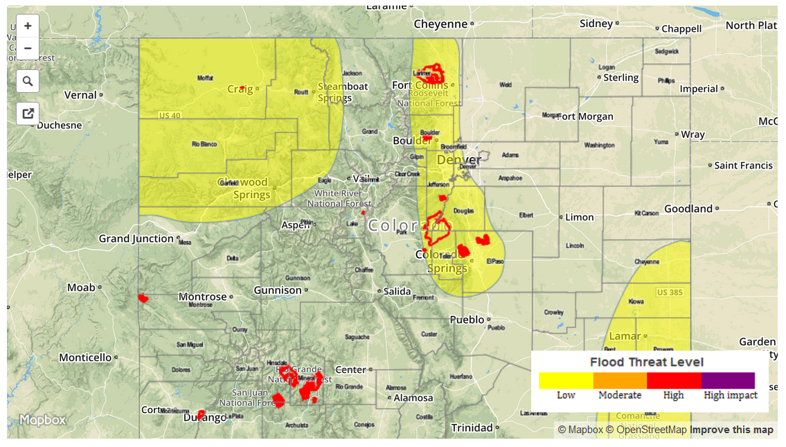
Zone-Specific Forecasts
Urban Corridor, Front Range, Northeast Plains, Palmer Ridge, Southeast Plains, Southeast Mountains and Raton Ridge:
Overcast with showers developing by early afternoon. Rain rates of 0.4 to 0.7 inches per hour will be possible across this entire area. In the far southeast portion of the Southeast Plains, more sunshine will cause strong to isolated severe thunderstorms capable of producing rain rates up to 2 inches per hour. A low flood threat has been issued for parts of this area.
Central Mountains, San Juan Mountains, San Luis Valley and Southwest Slope:
Morning cloud cover partially break up leading to some sunshine. Rain rates up to 0.5 inches per hour will be possible later in the afternoon as some instability develops. No flood threat is expected.
Northwest Slope, Grand Valley, and Northern Mountains:
Morning showers and isolated thunderstorms will expand in coverage and continue throughout the day. Rain rates will generally be less than 0.5 inches per hour, however later in the afternoon enough instability may allow for stronger thunderstorms with rain rates up to 0.9 inches per hour. A low flood threat has been posted for isolated flash flooding, debris slides and mud flows.