Issue Date: Monday, May 23rd, 2016
Issue Time: 9:00 AM MDT
Summary:
As the upper-level low shifted to the northeast yesterday, it ushered drier and slightly cooler air into Colorado. Meanwhile, a dryline laid across the far eastern plains. Everything together kept much of the state capped off, refusing to budge for any showers/thunderstorms. There were three exceptions to this:
- The central and northern mountains, where a few isolated high-based showers/storms developed during the afternoon and early evening, producing more wind than rain.
- Along and east of the dryline, where one or two isolated thunderstorms rumbled. This activity quickly moved into Kansas and had very little impact in Colorado
- Over the northern half of the Urban Corridor and adjacent Northeast Plains during the evening/overnight hours. A narrow ribbon of lift moved across the area, producing isolated-to-widely scattered showers along a narrow SW-to-NE oriented corridor. Brief light-to-moderate rainfall resulted.
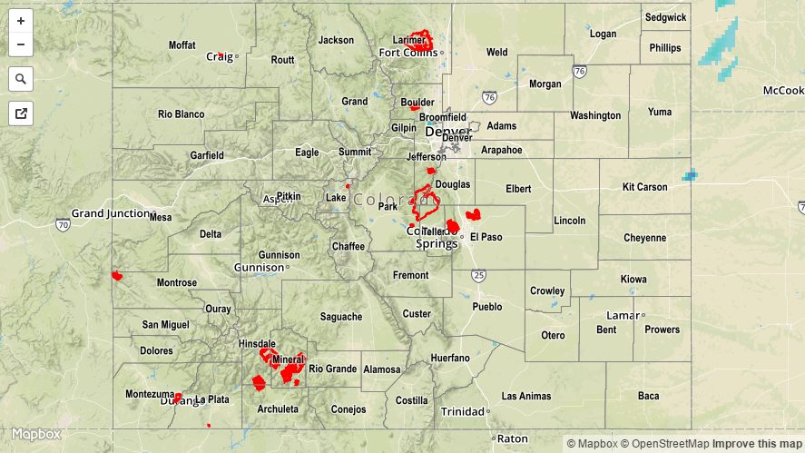
No flash flooding occurred yesterday. For a look at 24-hour precipitation, please see the STP map below.