Issue Date: 5/18/2016
Issue Time: 9:45 AM
A LOW FLOOD THREAT IS FORECAST TODAY FOR PORTIONS OF THE CACHE LA POUDRE RIVER AND SOUTH PLATTE RIVER.
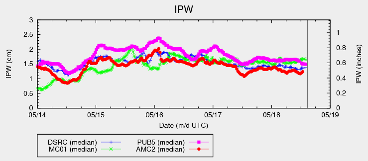
The upper-level low/trough that we have been discussing for a few days now will continue its slow, eastward progression during this period. This will keep temperatures cool (albeit slightly warmer than yesterday) while upper-level support brings about another day of showers and thunderstorms. Locations along and west of the Continental Divide will be favored for the greatest coverage of precipitation today, especially south of I-70. Elevations above 10,000 feet will continue to see precipitation fall as snow, bringing a few additional inches to the peaks. Sufficient moisture remains across the state, as noted in the IPW chart below, but instability will be fairly meager. Rain rates will not meet flash flood criteria, thus no flood threat is warranted.
East of the Continental Divide, coverage will be less. Expect widely scattered showers/weak thunderstorms across the Front Range/Southeast Mountains and adjacent foothills/plains, while areas further east stay mainly dry with only isolated showers. Rain rates in these regions will remain below flash flood threat thresholds, so no flood threat will be issued. For more details on timing/rain rates, please see the zone-specific forecast discussions below.
Today’s Flood Threat Map
For more information on today’s flood threat, see the map below (hover over threat areas for more details). For Zone-Specific forecasts, jump below the map.

Zone-Specific Forecasts
Front Range, Southeast Mountains, Urban Corridor, Northeast Plains, Southeast Plains, Palmer Ridge, and Raton Ridge:
Widely scattered showers/weak thunderstorms over the Front Range/Southeast Mountains and adjacent portions of the Urban Corridor, Palmer Ridge, Raton Ridge, and Southeast Plains. Further east, isolated showers will be about all the atmosphere can muster. Maximum rain rates will vary, with mountain/foothills locations at 0.3-0.6 inches/hour, and lower elevations at 0.25-0.5 inches/hour.
Timing: 11 AM – 9 PM, with only a few showers lingering over the Southeast Mountains into the early morning hours
Northern Mountains, Northwest Slope, Central Mountains, Grand Valley, Southwest Slope, San Juan Mountains, and San Luis Valley:
Scattered showers/weak thunderstorms expected, with the best coverage south of I-70. As noted above, elevations above 10,000 feet will see precipitation fall as snow; some of the higher peaks of the San Juan Mountains and Southwest Slope region will pick up 4-8 inches.
Elsewhere, rain rates are not expected to reach flash flood thresholds. Max rain rates will be 0.5-0.8 inches/hour. Persistent rainfall in a few locations south of I-70 will bring 0.5-1.0 total inches of rain.
Timing: 11 AM – 9 PM, with a few isolated showers continuing into the early morning hours.