Issue Date: Wednesday, May 18th, 2016
Issue Time: 9:00 AM MDT
Summary:
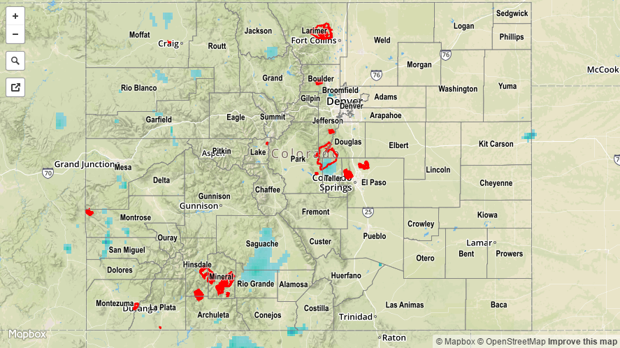
Much of the state remained under cloudy skies yesterday as the upper-level trough continued its slow progression to the east. In general, the High Country received the best coverage of showers and thunderstorms, thanks to being underneath the best upper-level support. Upslope flow across eastern Colorado helped support scattered showers/weak thunderstorms over the foothills and adjacent plains, while isolated showers dotted locations further east. Rain rates were not high enough to cause any flash flooding issues as the atmosphere remained too cool/stable.
Rainfall winners, according to CoCoRaHS observers (reports as of 7:00 AM MDT):
Mesa County: 0.81 inches
Pueblo County: 0.42 inches
El Paso County: 0.32 inches
Rio Grande County: 0.30 inches
La Plata County: 0.30 inches
Alamose County: 0.26 inches
A Flood Advisory has been issued/continues for the Cache La Poudre River near Greeley, and the South Platte River near Kersey, due to the past few days of rain combined with high country snow melt. Overflow in low-lying areas is only concern as the river levels are well below flood stage. For a look at 24-hour precipitation, please see the STP map below.