Issue Date: Sunday, May 15th, 2016
Issue Time: 9:10 AM MDT
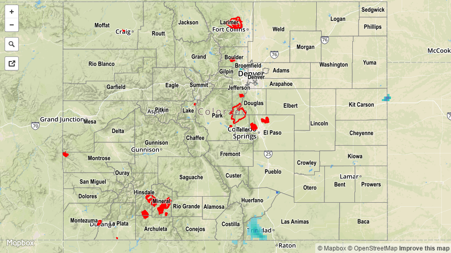
The Continental Divide is not just a mountain barrier that separates hydrologic basins. Often times, it also has a strong influence on weather patterns. Such was the case on Saturday when stubborn low clouds held their ground east of the Divide, while sunshine was the norm over the higher terrain and western Colorado. The strong May sunshine resulted in a quick emergence of cumulus clouds, which then transitioned to widely scattered showers and even an isolated thunderstorm. However, with negligible instability and unfavorable mid and upper-level dynamics, precipitation amounts stayed light. Between 0.1 and 0.2 inches were observed across lucky locations over the Palmer Ridge, Southeast Mountains, San Luis Valley and Southwest Slope. A weak thunderstorm was noted over Delta, CO through its generation of 60 mph wind gusts that “knocked down a 35 to 40 foot tall healthy cottonwood tree” according to a local storm report.
For specific rainfall estimates in your area, please check our STP map below.