Issue Date: 5/14/2016
Issue Time: 10:25 AM MDT
NO FLOOD THREAT IS FORECAST.
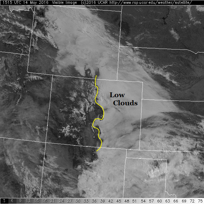
Colorado remains downstream of a weak upper-level ridge. Though the ridge may be weak, it is still a ridge, and will cause overall downward motion in the mid-levels of the atmosphere today. Meanwhile, as shown nicely in the visible satellite image below, a low cloud deck has setup shop below about 8,000 feet east of the Continental Divide. This is courtesy of the shallow, moist cool front passage yesterday. The low cloud deck will slowly erode, but will limit how much heating will occur under its footprint. This will leave most of eastern Colorado with below normal temperatures.
The best chances for rainfall today will be in the southern part of the state. As the Southeast Mountains, Raton Ridge break out of the cloud deck, there will be enough moisture and instability to kick up at least an isolated shower and even a weak thunderstorm. However, rain rates will be far below levels required for flooding. Thus, no flood threat is expected today.
Looking ahead, active weather will return to our state late Sunday, and continue into Monday.
Today’s Flood Threat Map
For more information on today’s flood threat, see the map below (hover over threat areas for more details). For Zone-Specific forecasts, jump below the map.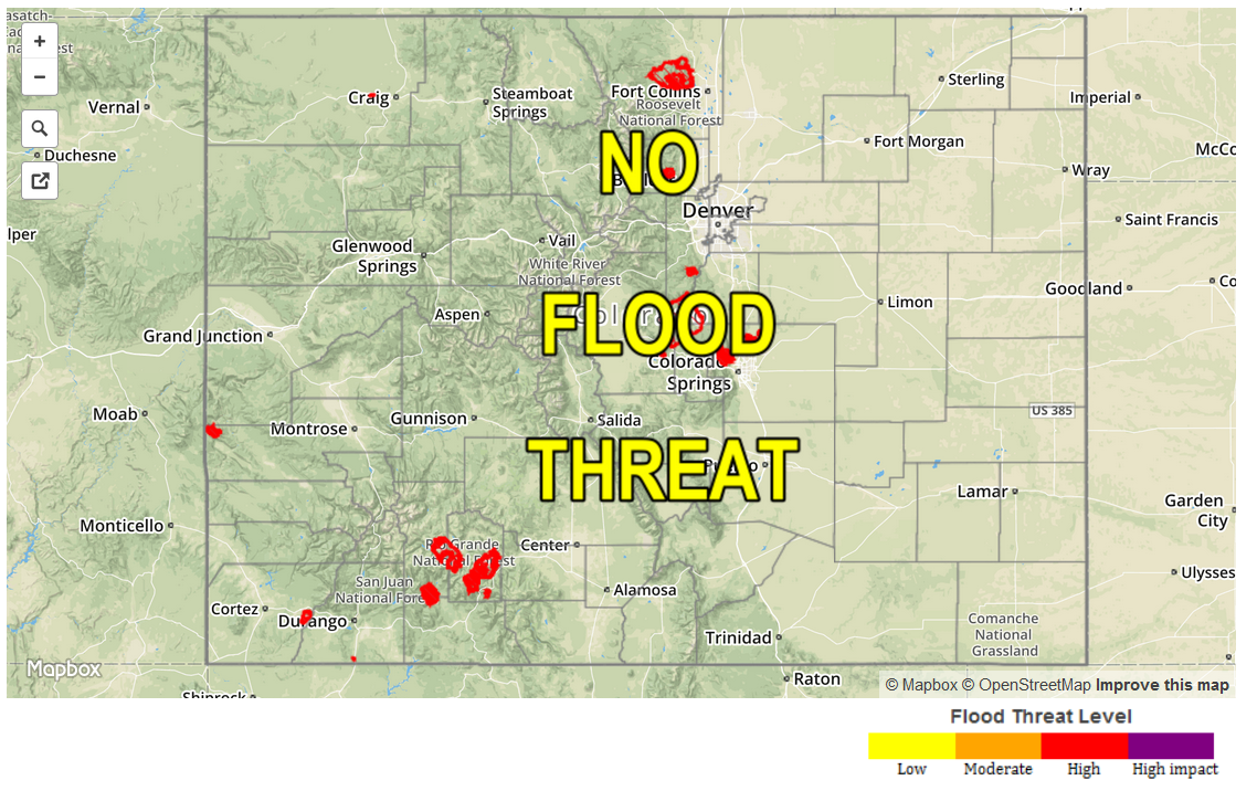
Urban Corridor, Front Range, Northeast Plains, Palmer Ridge, Southeast Plains:
Overcast early with clouds slowly eroding by mid-afternoon. Areas with sunshine will quickly jump into the low 70s. However, areas that hold on to clouds the longest may struggle to get to 60F. No flood threat today.
Central Mountains, Southwest Slope, Northwest Slope, Grand Valley, and Northern Mountains:
Sunny and mild today with near average temperatures. A few clouds will develop especially towards the south, with a possible shower or two. Maximum hourly rain rates will be below 0.1 inch. No flood threat today.
San Juan Mountains, San Luis Valley, Southeast Mountains and Raton Ridge:
Sunny early with cumulus clouds popping up by early afternoon. Isolated to scattered showers and even a weak thunderstorm will be seen from early afternoon to the early evening hours. Maximum hourly rain rates of 0.3 inches are possible, especially over the Raton Ridge. No flood threat today.