Issue Date: Saturday, May 14th, 2016
Issue Time: 9:20 AM MDT
Summary:
Colorado was located between a strong trough to our east, and a weak ridge to our west on Friday the 13th. With no moisture feed and little to no dynamics, almost everyone stayed dry. The most eventful part of the day was a cool front that surged southward east of the Divide, kicking up wind gusts up to 30 mph. Intermittent and spotty drizzle and shower activity accompanied the front, squeezing out up to 0.1 inches of precipitation across the higher elevations of the Front Range between Denver and Fort Collins, as well as parts of the Palmer Ridge. Interestingly, a very large temperature range was noted across the state during the early afternoon. Behind the front, dreary low clouds kept temperatures in the mid 40s near the Nebraska border. Meanwhile, the southeast part of the state was basking in the sun with low 80s common. Typical Colorado fashion!
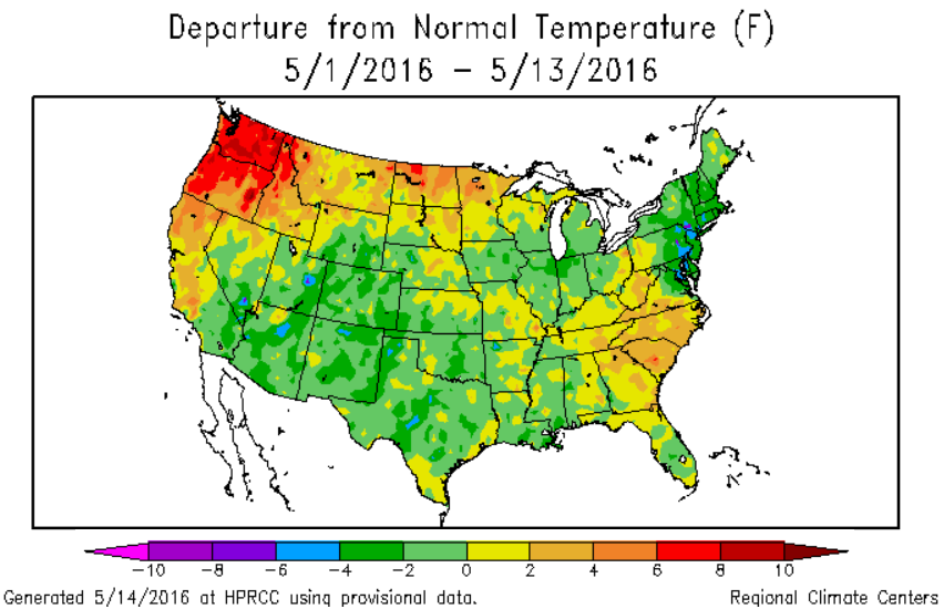
Taking a step back, the map above obtained from the High Plains Regional Climate Center, shows that it has been a cool start to May thus far across our state with temperatures running about 2-5F below normal. This has put a lid on snowmelt rates, with most sites above 10,000 feet either maintaining or very slowly adding to the already sizeable end of season snowpack.