Issue Date: Wednesday, May 11th, 2016
Issue Time: 9:00 AM MDT
Summary:
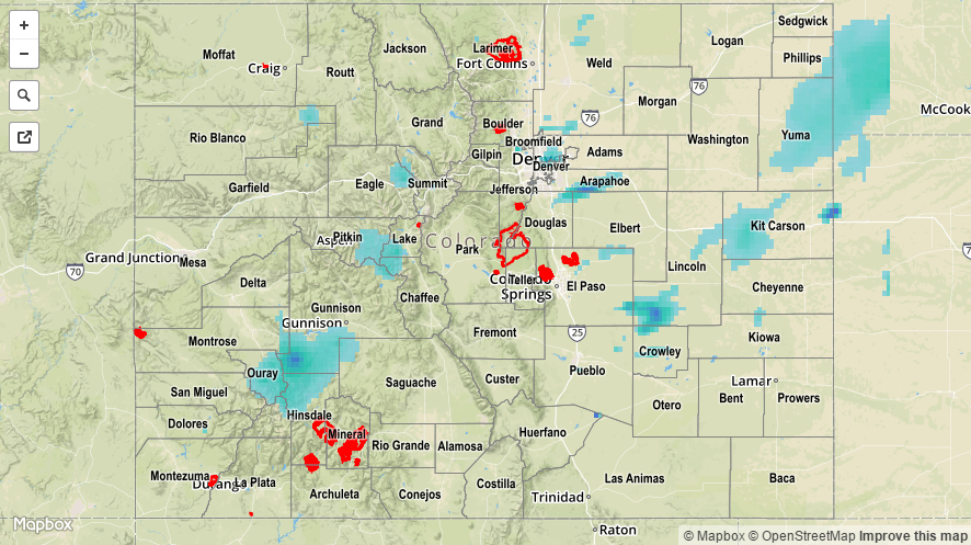
A cool front passing through the state combined with a mid-/upper-level disturbance to bring about another period of scattered showers and thunderstorms. The cool front provided a focus for storm activity, with afternoon/evening showers and thunderstorms being confined mainly between I-76/Highway 50 over eastern Colorado, and south of I-70 over the High Country. Only a few isolated showers/weak thunderstorms were able to get going elsewhere.
Rainfall winners, according to CoCoRaHS (reports as of 7:00 AM MDT):
Denver County: 0.61 inches
Ouray County: 0.57 inches
Yuma County: 0.40 inches
Larimer County: 0.36 inches
Douglas County: 0.31 inches
One severe weather report was submitted for 1.0” diameter hail in El Paso County, 2 miles NNE of Falcon.
No flash flooding occurred yesterday. A Flood Advisory is ongoing for the Cache La Poudre River from Windsor through Greeley, for the potential to flood low lying areas. It is not expected to reach flood stage. For a look at 24-hour precipitation, please see the STP map below.