Issue Date: Tuesday, May 10th, 2016
Issue Time: 9:00 AM MDT
Summary:
The upper-level trough slowly shifted eastward across the state yesterday, providing broad-scale support for another period of showers and thunderstorms. IPW values hovered near average for the usual reporting stations, but climbed into the 90th percentile for the Grand Junction station. The better availability of moisture over the High Country, plus the influence of orographics, led to more numerous storms over the mountains, and more isolated activity over the lower elevations. Rain rates never reached flash flood thresholds, but persistent rainfall led to a few higher totals. A few showers continue this morning.
Rainfall winners, according to CoCoRaHS (reports as of 7:00 AM MDT):
Eagle County: 1.0 inches
Routt County: 0.91 inches
Mesa County: 0.68 inches
Delta County: 0.68 inches
Garfield County: 0.59 inches
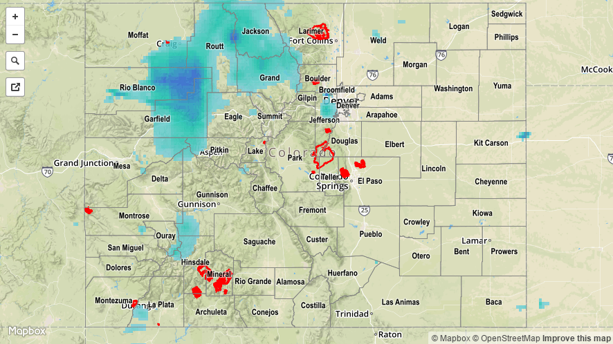
No flash flooding occurred yesterday. A Flood Advisory is ongoing for the Cache La Poudre River from Windsor through Greeley, for the potential to flood low lying areas. It is not expected to reach flood stage. For a look at 24-hour precipitation, please see the STP map below.