Issue Date: 5/04/2015
Issue Time: 2:45 PM

Welcome back to the Flood Threat Outlook. For the 2015 season, a few subtle changes have been made that will be best for the predictive value of the FTO product. Instead of breaking the 15 days up into three 5-day periods (0-5, 5-10, and 10-15), this year’s product will instead be produced on an event basis through the entire 15 day period. This will provide greater clarification and value to this extended range forecast. With all of that said…
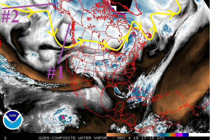
Over the next 15 days, there are 2 events for which this FTO will be focused upon.
- Event #1: Tuesday (5-5-2015) through Sunday Evening (5-10-2015)
- An upper-level low, marked by the purple line (and #1) in the water vapor image below, will begin to meander its way southward over the next few days, and in doing so, will bring an extended period of cool, wet weather to Colorado. This event will provide some of the best moisture that the state has experienced in quite some time due to the duration of the event.
- Event #2: Tuesday (5-12-2015) through Thursday (5-14-2015)
- After a short lull following Event #1, the next upper-level system will drop southward along the west coast by Tuesday. This system will eject a few disturbances in the southwest flow across Colorado. Event #2 should be described as the appetizer to the main course (Event #3), but Event #3 falls just outside of our 15-day range; it will be monitored closely for inclusion in Thursday’s FTO.
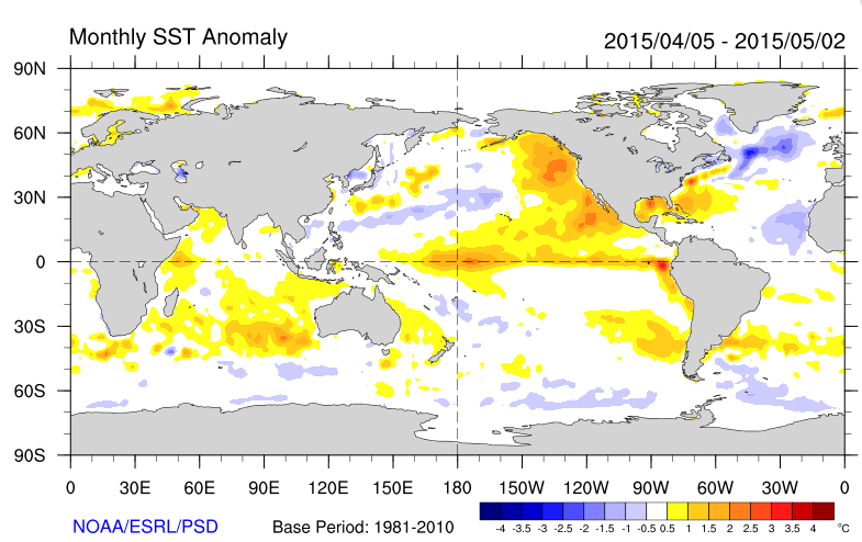
In the longer time-frame, we are watching the continuing of the weak El Nino. If El Nino continues into the summer, the odds for a wetter season will increase. This will be important to keep our eye on as the early flooding season progresses.
Event #1: Tuesday (5-5-2015) through Sunday Evening (5-10-2015)
Slow-Moving System Brings an Elevated Flood Threat
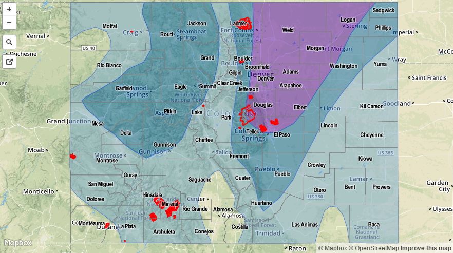
The upper-level low is not in a hurry to move eastward, and seems to be vacationing a bit over the western US. This will put, and leave, Colorado within a preferred zone for large-scale lift. This will allow for scattered showers and thunderstorms to continue for a string of 5-6 days. The one thing that can make or break this wet forecast is the amount of moisture that remains in place for use by the upper-level system. Tuesday and Wednesday will hold the best moisture, then moisture will erode somewhat for Thursday and Friday morning, then return Friday afternoon through Saturday, and erode again on Sunday as the upper-level low finally pushes off to the east. Summed up, this means the wettest days will be Tuesday, Wednesday, Friday and Saturday.
Many places across the state will see more than 1 inch of liquid precipitation by the time the event is over, with the mountains above 12,000 feet picking up a bit of snow to help the snowpack. Check out the map below for an overview of the expected rainfall totals statewide.

Event #2: Tuesday (5-12-2015) through Thursday (5-14-2015)
No Flood Threat from the “Appetizer”
The upper-level low responsible for Event #2 will be hanging out along the west coast for a few days, beginning on Tuesday. Unlike Event #1, this upper-level low will be centered too far west to provide the best large-scale forcing over Colorado. However, the placement of this low will allow it to eject a few mid-level disturbances that will traverse across Colorado, providing the trigger mechanism for afternoon and evening rounds of isolated-to-scattered showers and thunderstorms. The best chances during this period for heavy rain will be across the Palmer Ridge and far Northeast/Southeast Plains, where the best moisture will be available. This event period has much less moisture to work with, overall, as compared to Event #1.