Issue Date: 9/24/2015
Issue Time: 9:20 AM
Summary:
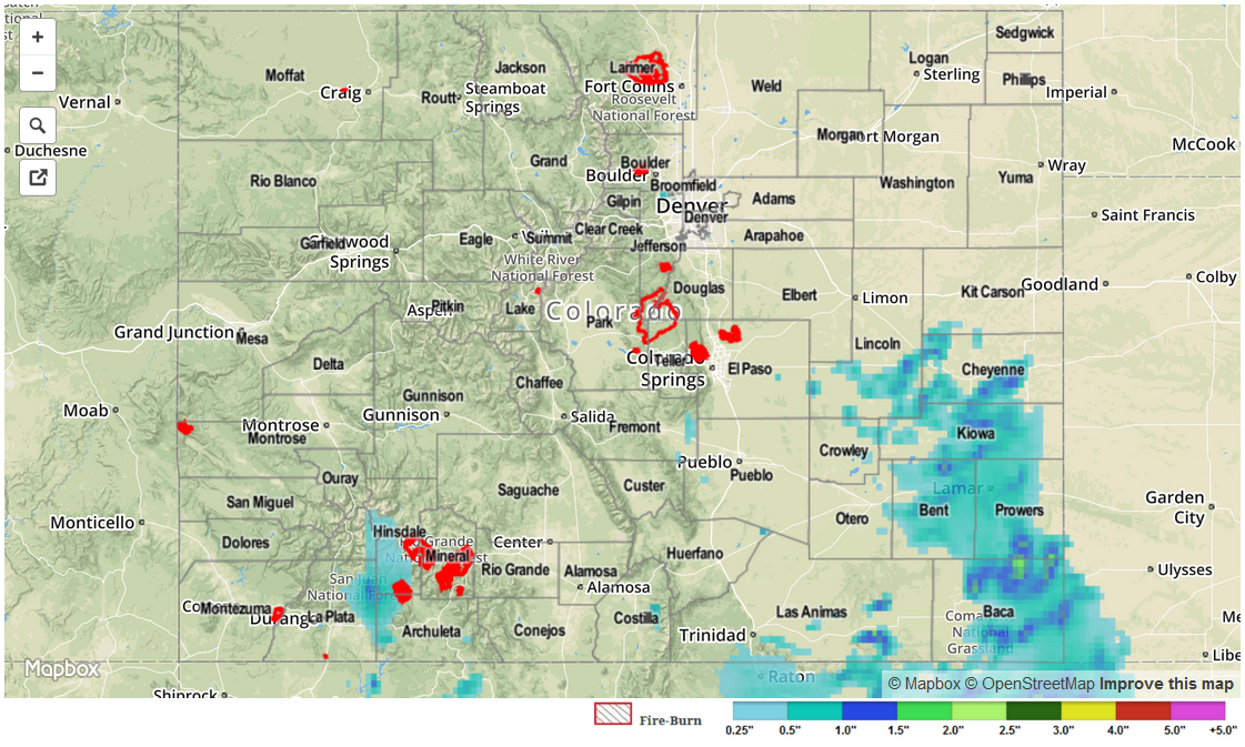
Thunderstorms once again moved across the landscape of the Southeast Plains and Palmer Ridge on Wednesday afternoon and evening. Coverage and intensity was not quite as high as Tuesday, but heavy rainfall was nonetheless observed. The highest 24-hour totals came from Otero and Baca counties where 1.08 and 0.98 inches were observed, respectively. However, our radar estimated map, below, suggests amounts up to 1.6 inches may have fallen over rural parts of southern Prowers and northern Baca counties. Separately, heavy rainfall was also observed over Kiowa County, prompting an Areal Flood Advisory.
On the other side of the Divide, showers and weak thunderstorms were observed over the San Juans with up to 0.8 inches of rainfall falling. Additionally, hail of 1.25 inch diameter was reported in La Plata County during the peak of the activity in the late afternoon.
For everyone else, it was a typical fall day with a few scattered showers amidst mostly sunny to partly cloudy skies.
Flooding was not reported yesterday. For estimated rainfall in your area, check out radar-estimated map below.