Issue Date: 9/21/2015
Issue Time: 9:00 AM
NO FLOOD THREAT IS FORECAST.
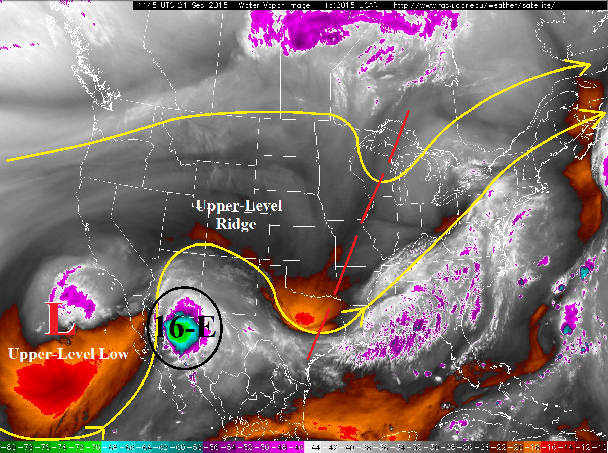
Under the influence of an upper-level ridge, Colorado will once again be dry and warm today. High temperatures across the state will be 4-10 degrees above average for the date under mostly sunny skies. Overall, winds will be fairly light except for far southeastern portions of the Southeast Plains region where gusts could reach 20 mph this afternoon/evening. Some changes are on the way for overnight tonight/tomorrow, as the upper-level low off the southern CA/Baja coast helps to funnel Tropical Depression Sixteen-E’s remnants across CA/AZ/NM. The flash flood threat is high for those states; Flash Flood Watches have been issued for portions of all three states.
The moisture plume will begin to encroach on Colorado during the evening hours as upper-level clouds will begin to filter across southern Colorado, and then overnight a thicker cloud deck will arrive over southwest Colorado. A few showers during the overnight/morning hours will be possible across the San Juan Mountains and Southwest Slope regions; otherwise, the main impact during this forecast period will be mild overnight lows as clouds serve as a “blanket” for outgoing radiation.
Today’s Flood Threat Map
For more information on today’s flood threat, see the map below (hover over threat areas for more details). For Zone-Specific forecasts, jump below the map.

Zone-Specific Forecasts
Urban Corridor, Northeast Plains, Raton Ridge, Palmer Ridge, and Southeast Plains:
Dry and hot for this time of year, with high temperatures 4-8 degrees above average. Denver’s high temperature record of 88 F will flirt with being tied/broken this afternoon. High clouds will increase during the evening and overnight hours, especially for southern regions. No precipitation is expected.
Front Range, Northern Mountains, Northwest Slope, Central Mountains, Grand Valley, San Juan Mountains, Southwest Slope, Southeast Mountains, and San Luis Valley:
Mostly sunny and warm, with high temperatures 5-10 degrees above average across the area. High-level clouds will increase during the late afternoon and evening hours, with mid-level clouds moving in overnight for southern/southwestern regions. A few isolated showers will accompany the mid-level clouds overnight for the Southwest Slope and San Juan Mountains regions, resulting in no more than light rain (0.25 inches/hour maximum).
Timing: Midnight – 11 AM