Issue Date: 9/20/2015
Issue Time: 9:03 AM
NO FLOOD THREAT IS FORECAST.
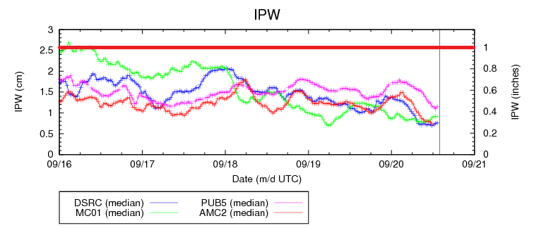
Inching nearer to the end of the FTB season, no flood threats become increasingly common as precipitable water, on average, falls throughout the month of September. A quick glance at the IPW chart below shows a steady decrease in moisture over the last 4 days or so, and this pattern will continue today. The dry air mass over Colorado will warm quickly today, allowing temperatures to climb a few degrees higher than yesterday. There isn’t much else to discuss in today’s forecast other than to get outside and enjoy the sunshine and warmth.
Today’s Flood Threat Map
For more information on today’s flood threat, see the map below (hover over threat areas for more details). For Zone-Specific forecasts, jump below the map.

Zone-Specific Forecasts
Urban Corridor, Northeast Plains, Raton Ridge, Palmer Ridge, and Southeast Plains:
Mostly sunny and warm, with high temperatures climbing a few degrees higher than yesterday. Overnight, the clear skies and dry air will allow for plenty of cooling, resulting in chilly overnight low temperatures.
Front Range, Northern Mountains, Northwest Slope, Central Mountains, Grand Valley, San Juan Mountains, Southwest Slope, Southeast Mountains, and San Luis Valley:
Abundant sunshine with high temperatures warming a few degrees higher than yesterday. Overnight, the clear skies and dry air will allow for temperatures to cool quickly, resulting in temperatures falling into the upper 30s/low 40s for lower valleys and to near, or just below, freezing across the higher elevations.