Issue Date: Friday, September 30th, 2022
Issue Time: 10:15 AM MDT
Summary:
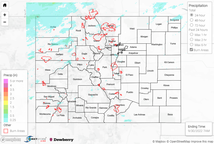
High elevation showers and storms developed by early afternoon on Thursday, with the heaviest precipitation falling over northwestern portions of the state roughly along and west of I-25 and along and north of I-70. In this region, QPE data and rain gauge observations suggest that amounts up to 0.50” were observed under the most intense cells. Notable rain gauge observations include:
• 0.45” near Trappers Lake
• 0.44” near Glenwood Springs
• 0.40” north of Glenwood Springs
• 0.33” near Kremmling
QPE data suggests isolated lighter amounts of 0.25” or less across portions of the San Juans, southern Front Range/Urban Corridor, Palmer Ridge, Northeast Plains, and Southeast Mountains.
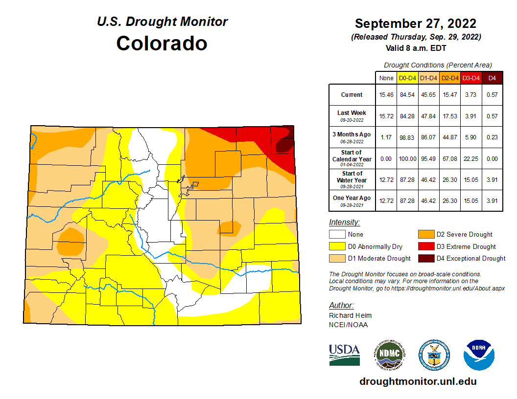
Looking at the U.S. Drought Monitor updated yesterday morning, we see a further reduction in moderate, severe, and extreme drought conditions (by percent area) across the state compared to last week, while the percent area of exceptional drought conditions remained unchanged.
No flooding was reported yesterday. For precipitation estimates in our area, check out the map below. Remember, if you observe flooding in your area, you can use the “Report a Flood” page to make a flood report when you can safely do so.
Click Here For Map Overview