Issue Date: Wednesday, September 28th, 2022
Issue Time: 11:10 AM MDT
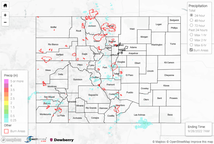
Summary:
A further increase in moisture resulted in increased shower and storm coverage for a broader swath of high terrain on Tuesday. The heaviest rainfall amounts were observed over the mountains of the Front Range and southward into the Southeast Mountains, where amounts up to 0.50” are indicated by QPE data. Notable rain gauge observations include:
• 0.43” near San Isabel
• 0.41” west of Colorado Springs
• 0.29” near Estes Park
• 0.23” near Guffrey
Across the San Juans, amounts were lighter with generally 0.25” or less; the highest observations were across the southern San Juans, particularly in the vicinity of Pagosa Springs. Elsewhere across the state, most locations remained dry with pleasant weather.
No flooding was reported yesterday. For precipitation estimates in our area, check out the map below. Remember, if you observe flooding in your area, you can use the “Report a Flood” page to make a flood report when you can safely do so.
Click Here For Map Overview