Issue Date: Thursday, September 22nd, 2022
Issue Time: 2:20PM MDT
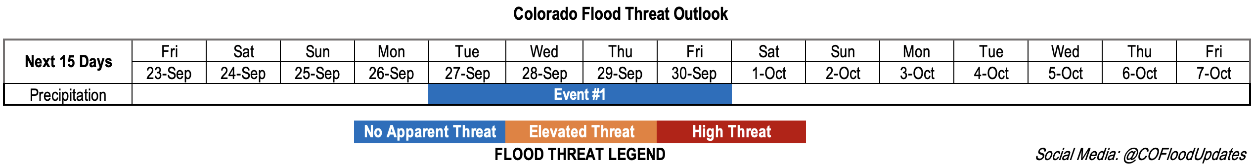
Valid Dates: 9/23 – 10/7
It looks like the active monsoon season will finally come to an end after today’s rainfall. After the Low to our northwest moves eastward, dry westerly and northwesterly flow aloft is expected to develop over the state. This should help to scour out any remaining moisture, and thus reduce the chance of precipitation heading into this weekend. Additionally, building High pressure should promote subsidence along with warming temperatures. There is a slight cool down forecast across the lower elevations of eastern Colorado on Sunday. There is also better model agreement that the weak cool front on Saturday will be lacking moisture, so a dry frontal passage is anticipated. The cooldown should only be a brief with temperatures returning to 3°F to 8°F above average by early next week.
Some vorticity is expected to pinch off of the trough shown in the water vapor imagery below (orange dashed line) over the next couple of days. Then another incoming trough is expected to push that mid-level lift under the ridging pattern next week. This should support a slight increase moisture over the state and aid in the return afternoon and evening storms to the forecast by mid-week (Event #1).
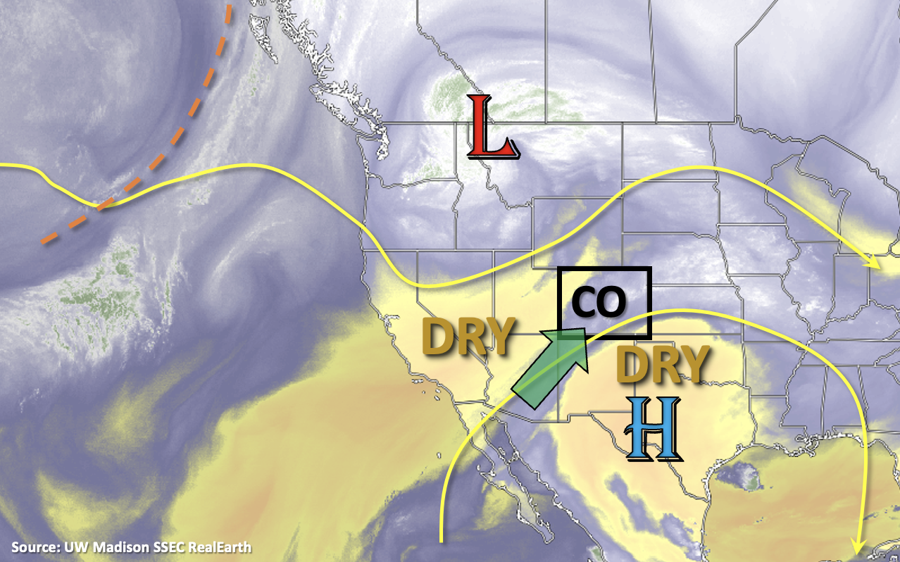
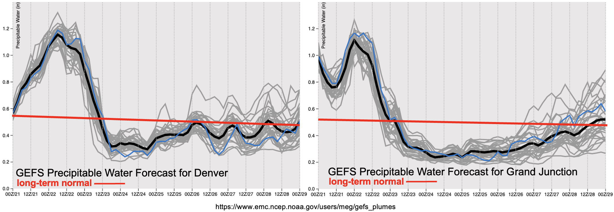
Although the plumes below are from Wednesday night’s GEFS run, you can see the model consensus regarding the quick drop off in PW values behind the Low. The narrow stream of subtropical moisture (green arrow, above) is expected to be cut off and dry air (yellow and orange shades, above) should fill in over the state. With this dry air mass helping to mix out the remaining surface moisture, and the next system only transporting in minimal moisture, rain rates are expected to remain below flood threat criteria for Event #1. For this reason, No Apparent flood threat has been issued.
Event #1: Tuesday – Friday (9/27 – 9/30)
No Apparent flood threat – Moisture and weak mid-level lift return to the area, which should cause widely scattered mountain storms to return.
Isolated to widely scattered afternoon and evening storms will return to the forecast by mid-week. The diurnally driven storms are expected to generally move west to east, and meaningful accumulation should stick to the mountains. Max 30-minute rain rates up to 0.5 inches will be possible over the central and south high terrain, so outside of some localized runoff, flooding is not expected. Models are still having some differences around timing, but it looks like there will be a peak in storm coverage either on Wednesday or Thursday. Be sure to tune into Monday’s FTO for the latest.