Issue Date: Wednesday, September 21st, 2022
Issue Time: 11:10 AM MDT
Summary:
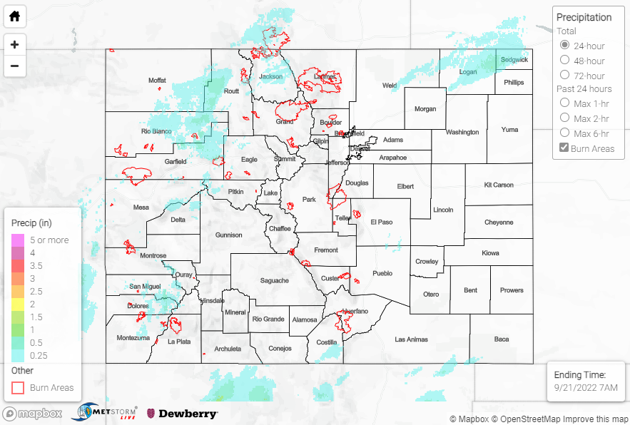
A late-season plume of moisture began making its way into the region on Tuesday, producing fairly widespread showers and embedded storms for the western half of the state. From the Northern Mountains southward across the western slope and into the San Juans, precipitation amounts were generally in the 0.25-0.50” range. Some notable rain gauge observations include:
• 0.55” near Dolores
• 0.42” southwest of Durango
• 0.39” east of Bayfield
• 0.31” near Placerville
• 0.30” near Buford
• 0.29” and 0.28” near Glenwood Springs
East of the Divide saw a relatively dry Tuesday for most locations. However, an area of showers and storms did impact the northern half of the Northeast Plains before dawn this morning, mainly along and north of the I-76 corridor, producing the heaviest rainfall amounts of the past 24 hours. QPE data suggests a general swath of 0.25-0.50” along with localized amounts approaching and exceeding 1.00”, particularly across Logan, Sedgwick, and Phillips Counties. Rain gauge coverage is sparse, with the highest rain gauge observation in this region being 0.40” near Crook.
No flooding was reported yesterday. For precipitation estimates in our area, check out the map below. Remember, if you observe flooding in your area, you can use the “Report a Flood” page to make a flood report when you can safely do so.
Click Here For Map Overview