Issue Date: Tuesday, September 20th, 2022
Issue Time: 11:00 AM MDT
Summary:
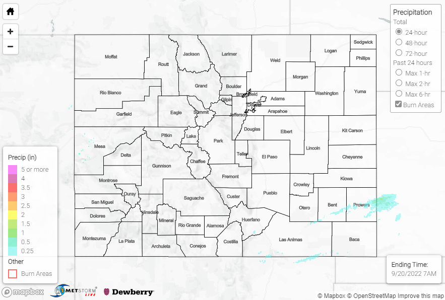
Monday featured mostly dry conditions across the state as the upper-level ridge continued to influence our weather, although three regions did observe some precipitation. The first region was the Grand Valley near Grand Junction, with very light amounts not exceeding 0.10”. The second region, which also saw very light rainfall amounts, was over and near the Palmer Ridge, with gauge observations again not exceeding 0.10”.
The last region, which experienced the heaviest precipitation, was a narrow swath from the Raton Ridge east-northeastward across the Southeast Plains and into Prowers County/western Kansas. Showers and storms that moved off the Ridge produced generally 0.25” or less, except across eastern Prowers where QPE data suggests amounts approaching and exceeding 1.00”. The highest rain gauge observation in Colorado associated with this precipitation was 0.30” from a CoCoRaHS observer near Holly; however, a few miles east of the border in Kansas saw observations of 1.16” and 0.95” near Coolidge.
No flooding was reported yesterday. For precipitation estimates in our area, check out the map below. Remember, if you observe flooding in your area, you can use the “Report a Flood” page to make a flood report when you can safely do so.
Click Here For Map Overview