Issue Date: Saturday, September 17th, 2022
Issue Time: 9:55 AM MDT
Summary:
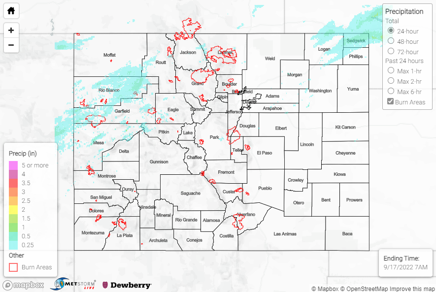
Friday featured precipitation across the northern half of Colorado, particularly along and north I-70/I-76, thanks to another shortwave trough. The I-70 corridor west of the Divide saw the heaviest widespread precipitation, with general amounts of 0.25-0.50”; locally higher amounts were also observed, including 0.81” northwest of Grand Junction and 0.53” in Grand Junction.
The other area that saw heavy precipitation, albeit much more isolated in nature, was the extreme northeastern corner of the state in Logan, Sedgwick, and Phillips Counties, where QPE data suggests amounts exceeding 1.50”. Notable rain gauge observations include 1.67” near Julesburg and 1.32” near Big Springs from CoCoRaHS observers. This heavy rainfall was from thunderstorms, with the convection prompting a Severe Thunderstorm Warning for Sedgewick County; no severe weather reports were received.
No flooding was reported yesterday. For precipitation estimates in our area, check out the map below. Remember, if you observe flooding in your area, you can use the “Report a Flood” page to make a flood report when you can safely do so.
Click Here For Map Overview