Issue Date: Saturday, September 17th, 2022
Issue Time: 8:55AM MDT
— Flooding is NOT expected today
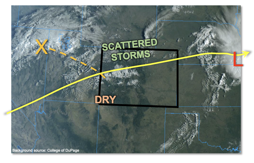
Little change in the overall weather pattern has occurred over the past 24 hours. As shown in the visible satellite image, below, WSW flow aloft continues overhead. However, the flow has increased in strength as a developing jet streak forms over the Great Basin. Moisture has stayed essentially steady since yesterday morning, with Grand Junction PW measuring 0.76 inches and Platteville coming in at 0.64 inches. However, some drier air is continuing to advect in from the south. Dynamics-wise, a weak, poorly organized mid-level disturbance was draped across Utah, stretching into southwest Colorado. As this disturbance moves across the northwest quadrant of the state, sufficient moisture will allow for widely scattered thunderstorms mainly along the Wyoming border. Additionally, a few convergence boundaries should result in the flare up of isolated to widely scattered storms over the Northeast Plains. In both areas, however, with the strong steering flow exceeding 20mph and limited instability, only 30-45 minutes of moderate intensity rainfall is expected. Thus, there is NO flood threat today.
Today’s Flood Threat Map
For more information on today’s flood threat, see the map below. If there is a threat, hover over the threat areas for more details, and click on burn areas to learn more about them. For Zone-Specific forecasts, scroll below the threat map.

Zone-Specific Forecasts:
Northwest Slope, Northern Mountains, Central Mountains, Front Range, Urban Corridor & Northeast Plains:
Partly cloudy with isolated to widely scattered showers and storms expected, beginning around noon. Max 30-min rain rates up to 0.3 inches (west of I-25) and up to 0.6 inches (east of I-25). Gusty winds up to 40 mph will also accompany the storms. Flooding is NOT expected today.
Primetime: Noon through 7PM
San Luis Valley, Grand Valley, San Juan Mountains, Southwest Slope, Southeast Mountains, Raton Ridge, Palmer Ridge & Southeast Plains:
Mostly sunny and seasonably warm with an isolated shower or storms possible over northern portions of the area. Max 30-min rain rates up to 0.2 inches. Gusty winds are expected this afternoon. Flooding is NOT expected today.
Primetime: Noon through 6PM