Issue Date: Friday, September 16th, 2022
Issue Time: 9:05AM MDT
— Flooding is NOT expected today
— Fire-Burn Forecast Summary: 5 burn areas under LOW threat; click HERE for more info
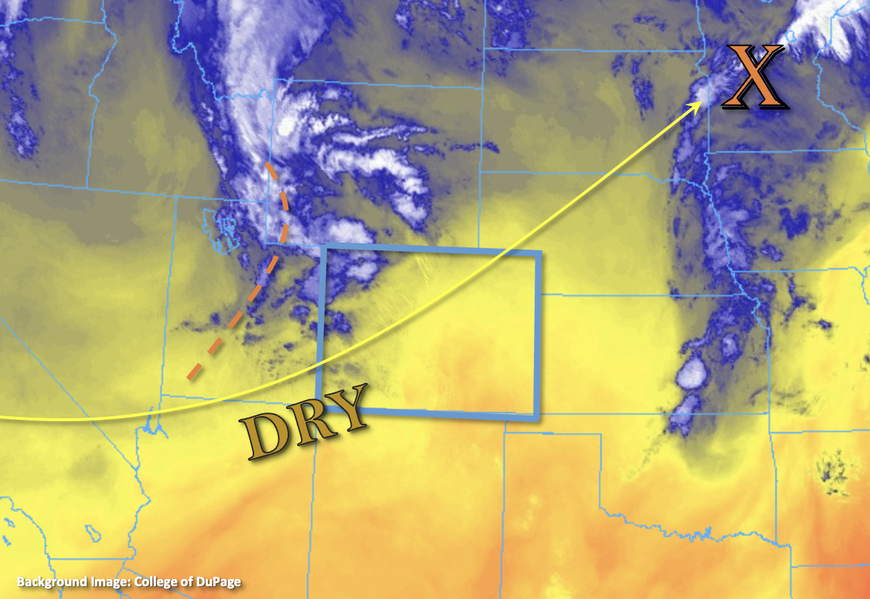
The moisture plume and mid-level lift that was responsible for the rainfall over the last couple of days has moved east of the state, as shown by orange “X” in the water vapor imagery below. A drier WSW flow filled in behind it, which is reflected in this morning’s PW values. PW at Platteville has dropped to 0.65 inches, and PW at Grand Junction was measured at 0.75 inches. The slightly higher value at Grand Junction is due to a little moisture from a weak incoming shortwave, which is marked by the dashed orange line below. This area of lift is already producing some weak thunderstorms over the northwest corner of the state. As this area of mid-level lift moves ENE throughout the day, it is expected to spark additional storms over the northern tier of the state. Scattered storms are anticipated to develop over the northwest and northern high terrain by midday with more isolated storm coverage forecast over the adjacent plains (north of I-70). Fast steering flows associated with a jet streak should keep storms moving pretty darn quick, so only brief rainfall is anticipated from the storm cores. Additionally, drying in the mid-levels should help reduce rainfall rates. Therefore, flooding is NOT expected today.
Today’s Flood Threat Map
For more information on today’s flood threat, see the map below. If there is a threat, hover over the threat areas for more details, and click on burn areas to learn more about them. For Zone-Specific forecasts, scroll below the threat map.

Zone-Specific Forecasts:
Northwest Slope, Grand Valley, Northern Mountains, Central Mountains, Front Range, Urban Corridor & Northeast Plains:
Additional storms are forecast to develop over the northern high terrain by midday with more isolated storms over the adjacent plains later this afternoon and evening. Max 30-minute rain rates up to 0.75 inches (west/plains) and 0.5 inches (Urban Corridor) will be possible. With fast storm motion and only moderate rainfall rates, flooding is NOT expected today. In addition to brief rainfall, storms may produce some stronger outflow winds (~45 mph) and lightning. Additional light showers are possible over the northwest corner overnight.
Primetime: Ongoing to 9PM
San Luis Valley, San Juan Mountains, Southwest Slope, Southeast Mountains, Raton Ridge, Palmer Ridge & Southeast Plains:
Very isolated storms may be possible over the high terrain this afternoon, but the drying trend will help produce more virga than wetting rainfall. It will likely get a little breezy over the mountains by this afternoon with gusts up to 30 mph possible across the higher peaks. High temperatures should be slightly cooler than average over western CO with temperatures reaching a few degrees above average over the plains and SLV.