Issue Date: Friday, September 9th, 2022
Issue Time: 9AM MDT
— Flooding is NOT expected today
Most of the state is waking up to much cooler temperatures this morning thanks to a passing cold front overnight and this morning marked in the water vapor imagery below (blue dashed). With the trough finally breaking up the strong ridge, the state is in for a more active rainfall day. Moisture behind the frontal passage will help to produce some light to moderate rainfall over the Front Range, and additional moisture from the outer bands of Hurricane Kay will help increase moisture across the southern border for widely scattered mountain storms. With westerly winds aloft, precipitation could spill into the adjacent plains with this most likely to occur over the western Raton Ridge.
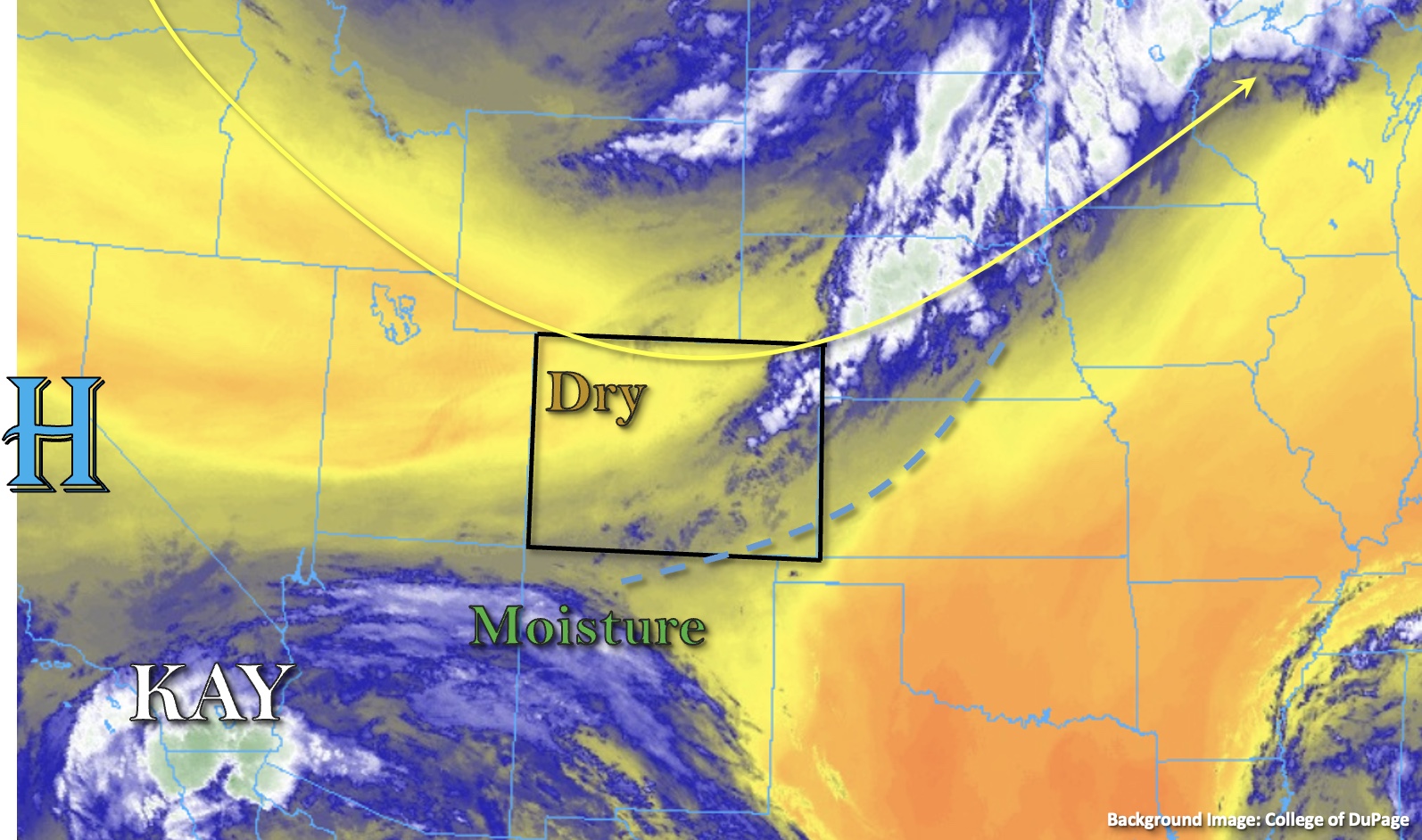
Taking a closer look at moisture over the state, there looks to be a drier air mass located over northwest Colorado, which is reflected in the 0.53 inch PW value at Grand Junction. PW at Albuquerque was measured at 0.68 inches, so values should increase across the southern border as the outer bands of Kay move northwards today. More importantly, dew points are not overly impressive across the southern border, which means storms are more likely produce strong outflow winds and only moderate rainfall rates. Due to the brief nature of the storms, flooding is NOT expected for the area.
Back over eastern Colorado, PW at Platteville has risen to about 0.75 inches behind the front, which is producing cloud cover over the area. With cooler and more stable conditions forecast for most of the area, rainfall should be confined to the Front Range. Again, surface moisture and instability are lacking, so the brief and isolated storms should produce lighter rainfall totals, so flooding is NOT expected. With a secondary push of colder air late this afternoon and evening, some overnight and early morning rainfall may occur over the Front Range with a dusting of snow possible at the highest peaks.
Today’s Flood Threat Map
For more information on today’s flood threat, see the map below. If there is a threat, hover over the threat areas for more details, and click on burn areas to learn more about them. For Zone-Specific forecasts, scroll below the threat map.

Zone-Specific Forecasts:
Southeast Mountains, San Juan Mountains, Southwest Slope, San Luis Valley & Raton Ridge:
Slightly better moisture both at the surface and upper-levels of the atmosphere is forecast over these zones, which means an uptick in precipitation coverage. Widely scattered storm development is expected by this afternoon over the high terrain. Westerly steering flows may allow for some rain to accumulate over the San Luis Valley and adjacent western Raton Ridge (most likely). Isolated max 30-minute rain rates up to 0.65 inches and local totals around 0.8 inches will be possible. In addition to moderate rainfall rates, more intense storms may produce some lightning and strong outflow winds (up to 45 mph). Flooding is NOT expected. Expected a cool and cloudy start tomorrow morning.
Primetime: 2PM to 11PM
Front Range, Urban Corridor, Palmer Ridge, Northwest Slope, Northern Mountains, Grand Valley, Central Mountains, Northeast Plains & Southeast Plains:
Much cooler start to the day for these zones with the exception of the lower elevations of the Grand Valley. Nonetheless, afternoon high temperatures for the Grand Valley should only reach into the mid-90s °F this afternoon, so still a cool-down when compared to previous days. Outside of the Front Range, these zones should be rain-free today. Some afternoon, post-upslope flow rainfall may be possible over the Front Range and minimal to little spillover is expected over the elevated Palmer Ridge area. A couple stronger rainfall cores may develop (most likely south) where max 30-minute rain rates up to 0.25 inches would be possible. Otherwise, rainfall should be stratiform and light, so flooding is NOT expected. Light precipitation may persist overnight for the Front Range and will likely expand into the Urban Corridor and Northeast Plains by early tomorrow morning. So, it’s going to be a cold, wet and cloudy start to the weekend.
Primetime: 3PM to Ongoing