Issue Date: Thursday, September 8th 2022
Issue Time: 2:45PM MDT
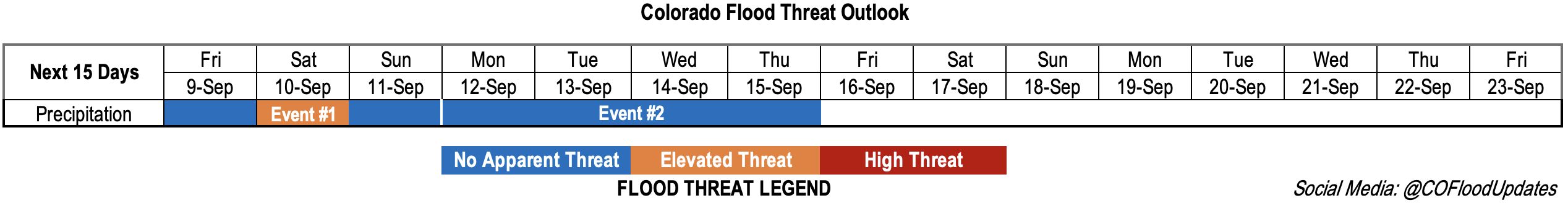
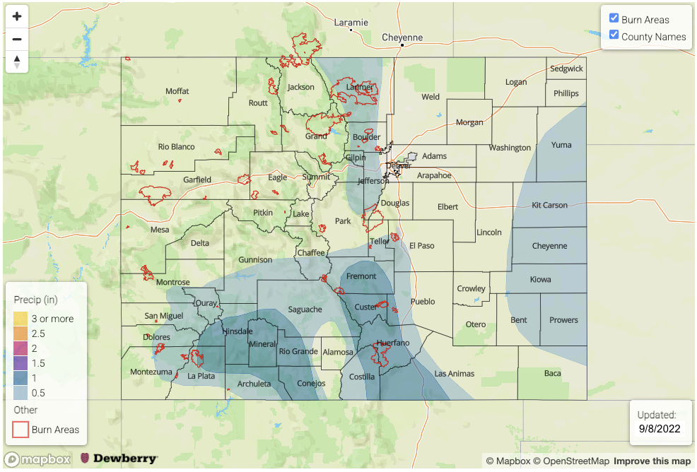
Valid Dates: 9/9 – 9/23
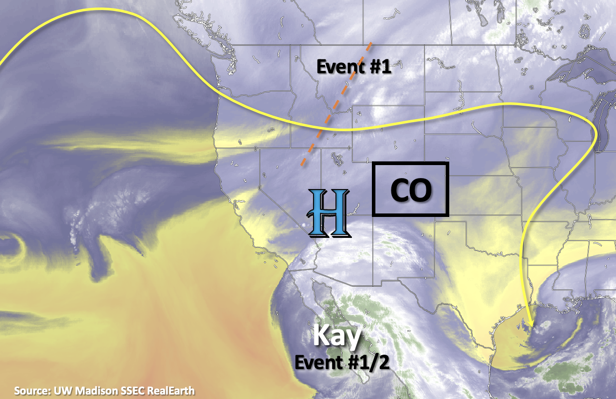
Heading into tomorrow, there should be some relief from this unseasonably hot start to September. After several days of broken temperature records, a cold front is expected to slide through the state tonight. This should help drop high temperatures several degrees over portions of eastern Colorado tomorrow, but to a lesser extent for areas west of the Continental Divide. A secondary and stronger cold front is forecast to push through late on Friday and into Saturday, which should more effectively reduce statewide temperatures for the weekend. This is all thanks to the passage of an upper-level trough which can be seen by the orange dashed line in the water vapor imagery below (Event #1). As the trough passes through, Hurricane Kay will continue to move northwards. Kay will likely help increase moisture across the southern border beginning tomorrow. On Saturday, the increase in dynamics from the trough and moisture from Kay may combine, which could cause a localized, low-end Elevated flood threat to be issued for portions of the southern high terrain. A few ingredients that would need to come together for the threat would be clear skies, warmer temperatures (south), and timing of the frontal passage/location of its associated dynamics. Additionally, near surface moisture will need to substantially increase to help produce more efficient rain rates.
The EPS has a slightly longer lull when compared to the GEFS before Event #2 begins early next week. It looks like another incoming, albeit weaker, trough will help to push the remnants of Hurricane Kay over the state from west to east. With a higher likelihood of the remaining moisture being located mainly in the mid and upper-levels of the atmosphere and the addition of faster steering flows and ongoing cloud cover limiting instability, means there is No Apparent threat issued at this time.
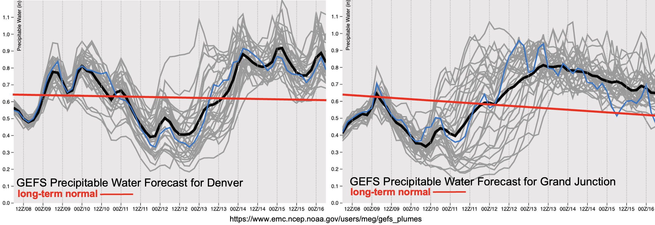
The PW plumes from the GEFS are now showing better consensus with the return of moisture for Event #1 (east) and for Event #2 (statewide). With the lower levels of the atmosphere likely remaining quite dry and less instability during Event #1, outside of the southern high terrain, there is No Apparent flood threat issued. As Event #2 begins, PW values are likely to rise to above normal values east and west, which translates into scattered to numerous storms returning to the forecast. At this time, not anticipating a lot of instability or too high of dew points, which means that the rain rates should only be light to moderate. So, there is No Apparent flood threat issued for Event #2.
Event #1: Friday – Sunday (9/9 – 9/11)
One day Elevated flood threat as some subtropical moisture and dynamics potentially combine over the southern high terrain.
The isolated to widely scattered storms on Friday into the overnight hours should mostly be confined to the northern and southern mountains. There may be some spillover possible near the elevated ridges with more zonal steering flows and dynamics present during the late afternoon and overnight hours. Best chance for precipitation accumulation will be across the southern high terrain, east of the Continental Divide where max 1-hour rain rates may reach up to 0.75 inches. By Saturday, cooler and more stable conditions along with widespread cloud cover are anticipated for much of the state. Best chance for some higher rain rates will be over the central and southern high terrain again with some spillover of storms possible into the immediate adjacent Southeast Plains. Rain rates may reach just over an inch an hour, so an Elevated flood threat has been issued. Elsewhere, light stratiform rainfall and mist is expected.
Event #2: Monday – Thursday (9/12 – 9/15)
Remnants of Kay should drift overhead from the west to east and cause an uptick in shower and storm coverage, but there is No Apparent flood threat issued.
Long-term guidance still has some differences with the timing of the increase in moisture from the remnants of Kay, but there is increasing confidence that there will be an uptick in storms and showers next week. The most scattered to widespread rainfall activity is likely to occur on Tuesday and Wednesday. Without much instability and surface moisture forecast at this time, not thinking there will be much of a heavy rainfall threat. Details about the final location of Kay and the timing of the next trough are likely to change, so be sure to tune back into the FTO on Monday as there might need to be a 1-day upgrade to the flood threat.