Issue Date: Thursday, September 8th, 2022
Issue Time: 9:45 AM MDT
Summary:
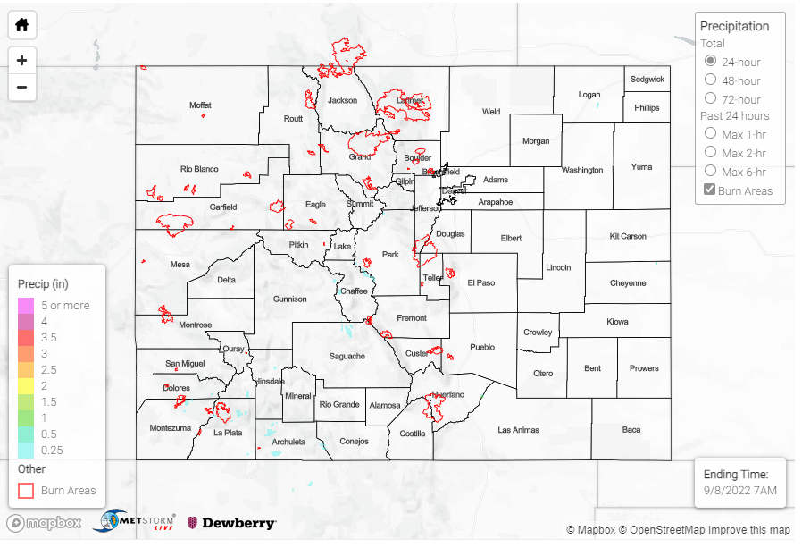
Colorado kept up the hot and dry weather yesterday, with record-breaking temperatures reported by the Boulder National Weather Service in Denver, Fort Collins, and Boulder among others. The state continued to see very little precipitation. A few 0.1” -0.12” observations were reported in the Central Mountains and Southwest Slope, but most areas received only a few hundredths of an inch if they saw any rainfall at all.
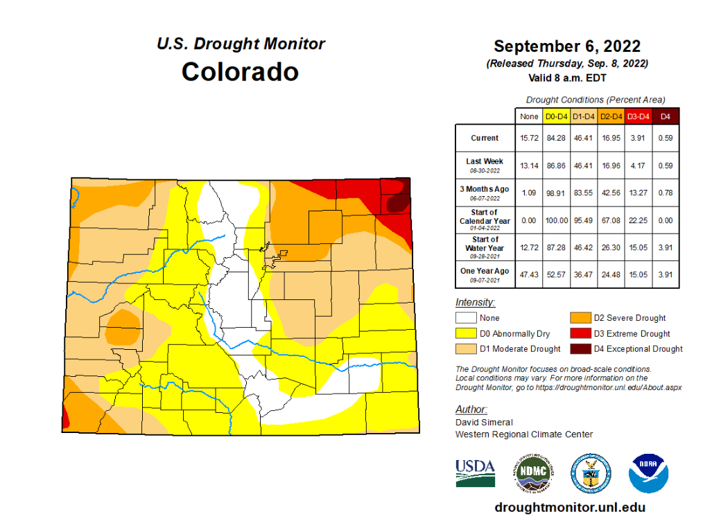
The state may have continued to see dry weather and record-breaking heat, but the drought monitor showed up improvements from last week. See the weekly drought monitor update below to view the improvements in most of the categories!
No flooding was reported yesterday. For precipitation estimates in our area, check out the map below. Remember, if you observe flooding in your area, you can use the “Report a Flood” page to make a flood report when you can safely do so.
Click Here For Map Overview