Issue Date: Monday, September 5th 2022
Issue Time: 1PM MDT
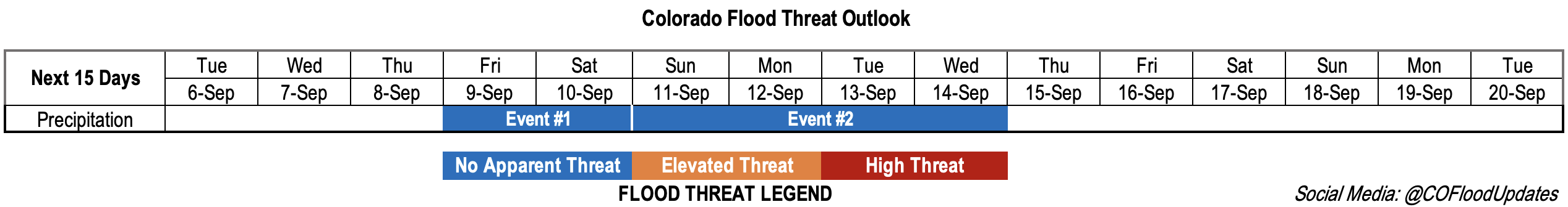
Valid Dates: 9/6 – 9/20
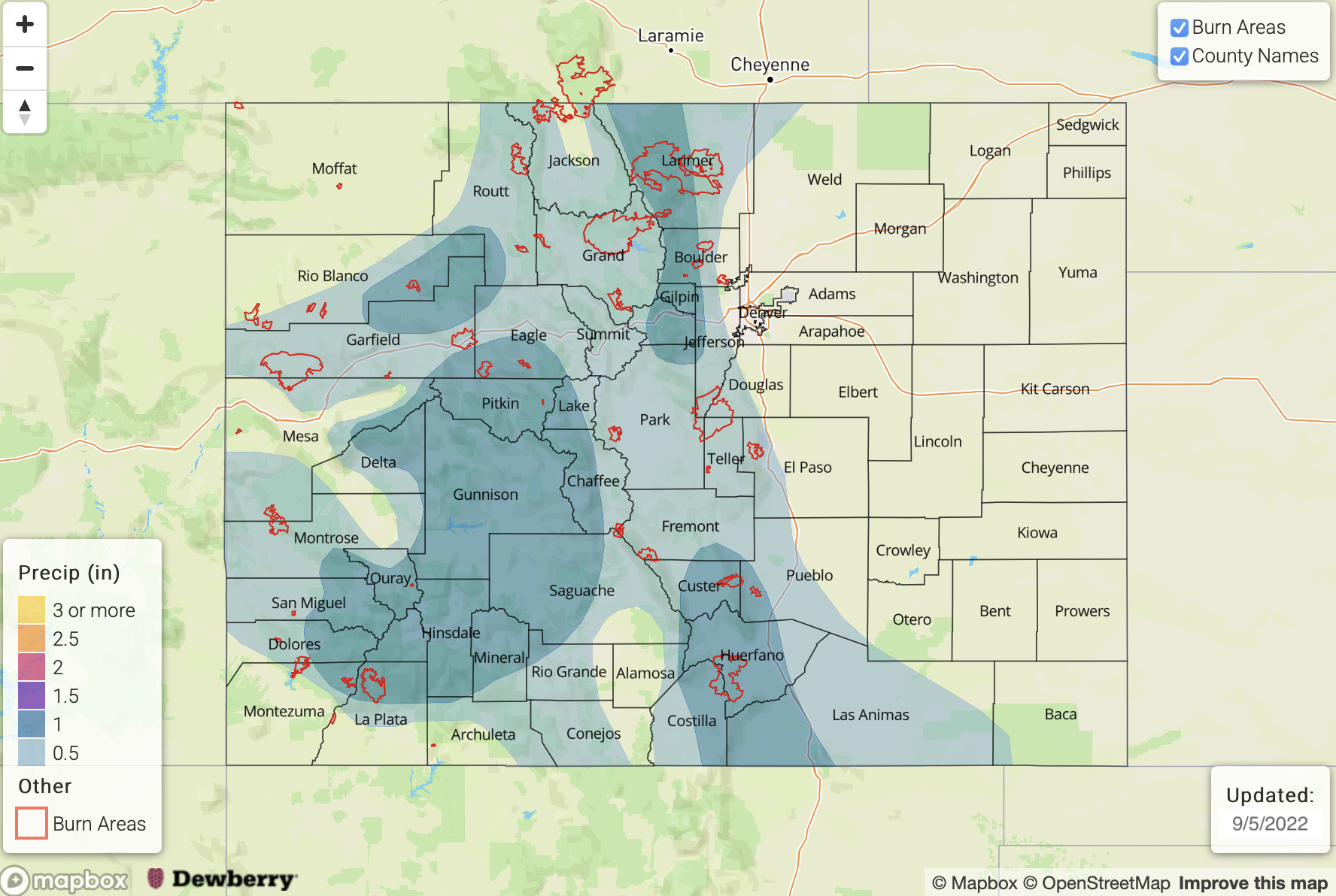
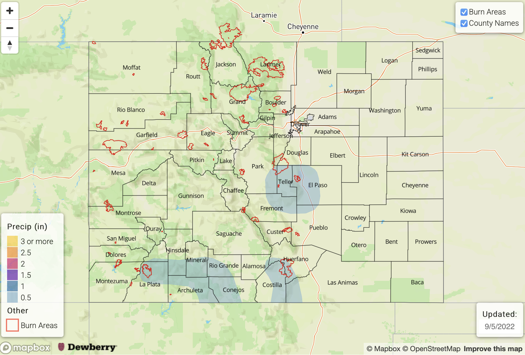
Yesterday marked the 85th consecutive day of precipitation occurring somewhere within the state. There were two weak mountain storms that developed during the late afternoon over Saguache and Gunnison County. Even though these storms likely only caused minimal accumulation, they helped keep the precipitation streak alive. Not sure how much longer the count can keep going since it’s going to be a hot and dry start to the work week.
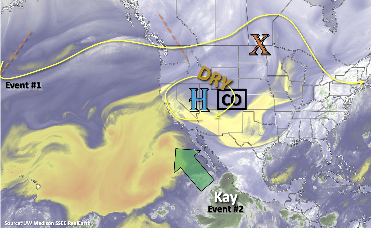
The first part of this week will feature an anomalous strong upper-level High, which will promote subsidence and continue to pull in a dry air mass from the north. During this period, only very isolated showers over the mountains may be possible with limited residual moisture. With the High’s grip over the state, afternoon temperatures are expected to remain much above average through Thursday. In fact, several areas may break their daily record high temperatures throughout the week. By the end of the week, a trough is expected to drop a very welcomed cold front through the state, which should help cool temperatures and return precipitation chances to the forecast (Event #1). Sunday will likely serve as a transition day between events before the remnants of Tropical Cyclone Kay potentially move into the state (Event #2). Uncertainty continues in the forecast for Event #2, but there is increasing confidence that there will be an uptick in rainfall chances at the beginning of next week.
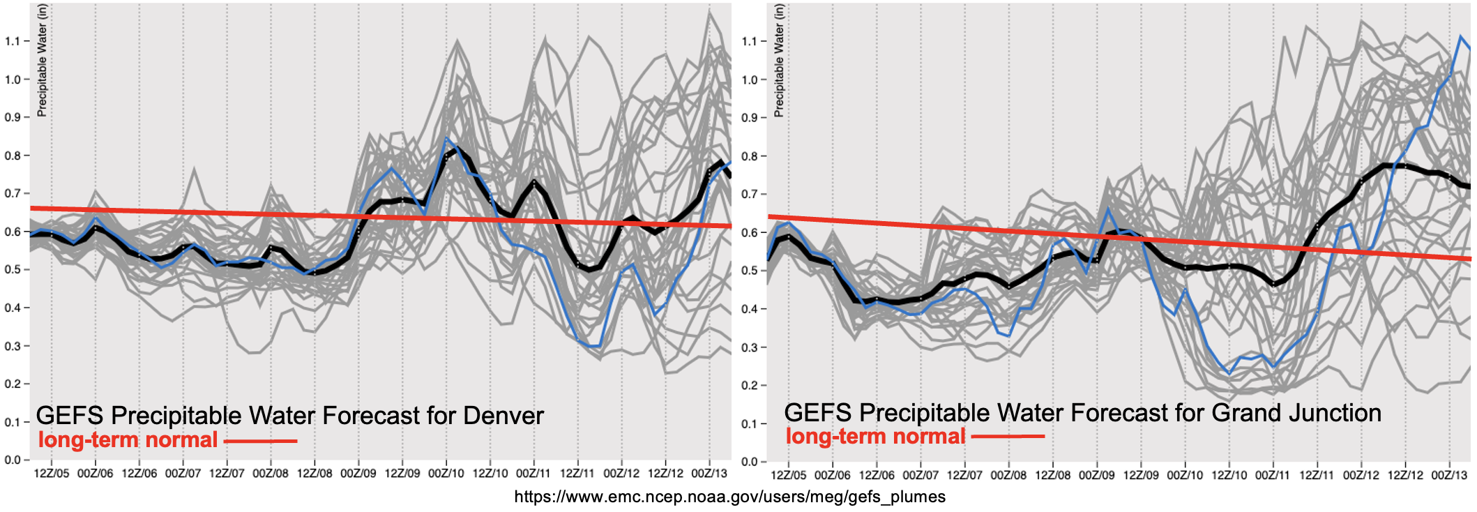
The PW plumes show below average values both east and west with the dry air mass overhead to start the forecast period (black line below red line). Even though the week is expected to start off quite dry and hot, lighter surface winds are anticipated under the ridge, which should help to suppress fire weather. While Event #1 looks to return moisture and some dynamics to the state, it looks like this event should be mostly confined to areas along and east of the Continental Divide. After Event #1, both plumes indicate that there is a good likelihood for a lull in moisture, and thus precipitation chances on Sunday. Then, Event #2 potentially kicks off as remnants of TC Kay move from west to east across the state. The large spread in ensemble members (gray lines) indicate uncertainty in the magnitude of moisture, but there will likely be an upward trend in PW, which should cause precipitation chances to increase next week. Currently, there is No Apparent flood threat, but we’ll be keeping an eye on the upper bounds of the potential moisture surge throughout the week.
Event #1: Friday – Saturday (9/9 – 9/10)
No Apparent flood threat with limited moisture and dynamics over eastern Colorado.
Best chance for precipitation during this event will be across the southern high terrain and elevated Palmer Ridge area where isolated max 1-hour rain rates may reach between 0.5 and 0.75 inches. There is a smaller chance for widely scattered storms over the adjacent plains, and with quick storm movement and limited surface moisture, any storms that do develop should pose more of a wind than heavy rainfall threat. Therefore, there is No Apparent flood threat issued at this time.
Event #2: Sunday – Wednesday (9/11 – 9/14)
Remnants of tropical moisture may drift overhead from the west and cause an uptick in rainfall chances, but currently, there is No Apparent flood threat issued.
Long-term guidance is now showing TC Kay tracking up the Baja Peninsula. The remnants of TC Kay may linger to our west and slowly increase PW values over the state. However, if the moisture and energy is able to track more quickly overhead, by way of a shortwave pushing it eastward, there is a higher chance for a low-end 1-day threat early next week. The likelihood of that happening is not high, so it’s more likely that the moisture will slowly move overhead and cause an uptick in precipitation chances first west, then east. Be sure to tune back into the FTO on Thursday as there may be better synoptic and mesoscale clarity for when and where the remnants of Kay will track.