Issue Date: Sunday, September 4th, 2022
Issue Time: 9:45 AM MDT
— Flooding is NOT expected today
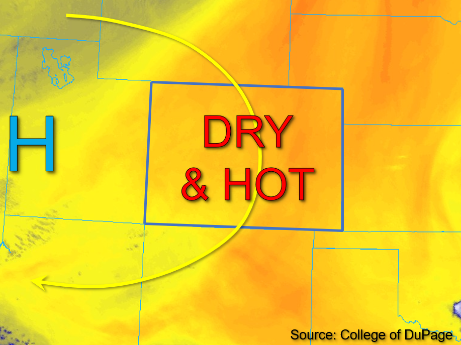
The position of the upper-level high-pressure center has shifted back toward the western Utah border with eastern Nevada as of this morning, as shown in the water vapor image below. Increasing subsidence from the High is expected to have an even greater influence in terms of storm suppression than prior days, yielding forecast temperatures several degrees above climatological average across Colorado today. Very dry conditions are predominant across the state with respect to both column and boundary layer moisture as well. PW values of 0.51 and 0.49 inches were measured in Grand Junction and Platteville this morning, respectively. Meanwhile, dew points in the 30s°F and 40s°F were common west of the Continental Divide, with low to mid-50s°F dew points commonly found east. Notably, with upper-level dynamics having exited the state yesterday, there is negligible forcing or uplift to trigger storm development today. Daytime heating circulations over the mountains later in the day may spawn a few cumuli or a light virga shower or two across higher elevations in southern Colorado. However, no meaningful precipitation is forecast, therefore NO flooding is expected today.
Today’s Flood Threat Map
For more information on today’s flood threat, see the map below. If there is a threat, hover over the threat areas for more details, and click on burn areas to learn more about them. For Zone-Specific forecasts, scroll below the threat map.

Zone-Specific Forecasts:
Southwest Slope, San Juan Mountains, San Luis Valley, Grand Valley, Central Mountains, Northern Mountains, & Northwest Slope:
Clear skies throughout the day will allow for ample daytime heating that should warm temperatures to several degrees above average today. High dewpoint depressions and negligible moisture at the surface and aloft should yield dry and hot conditions this afternoon. A few stray cumuli and perhaps an isolated virga shower or two may drift across the mountains in southwest Colorado late this afternoon. No meaningful precipitation is forecast, and NO flooding is expected today.
Front Range, Urban Corridor, Northeast Plains, Palmer Ridge, Southeast Mountains, Southeast Plains, & Raton Ridge:
Today, expect clear skies and temperatures several degrees above average for eastern Colorado. A few cumuli and perhaps a stray light virga shower or two may drift across the Southeast Mountains this afternoon. However, due to the negligible moisture and upper-level dynamics, no meaningful precipitation is forecast and NO flooding is expected today.